
I hadn't even gotten to the parking lot when I saw a coyote cross the street on Tennessee Road. In the pre dawn hours, the heavy fog had created a shroud, and the coyote disappeared in to the mist the way he had appeared, like a ghost.
In the parking lot, a Mama quail led her bevy of offspring to seek hidden nuggets in the thick brush. I got my gear and loaded up, eager to take a hike on this popular and scenic trail.
The most common and easiest route is the simple out and back to Tennessee beach. At a flat 1.7 miles to the beach, this is a simple and pleasant stroll for most people. However, to see what Northern California coastal beauty looks like, you'll need to climb a hill.
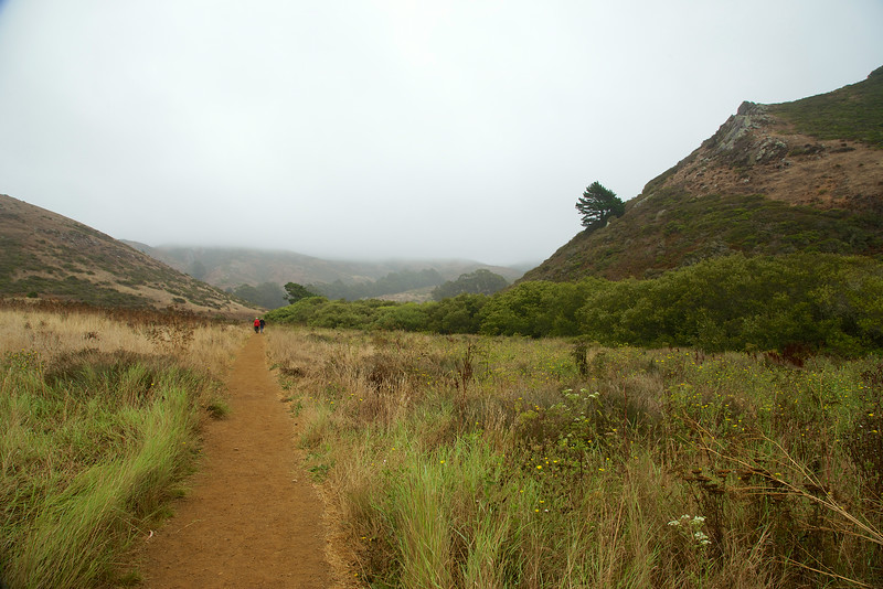
From the parking lot, follow the signs to Tennessee Beach. Starting out on the paved trail, the first trail on the right is the Haypress Camp Trail. The second trail on the right is this path, the Fox Trail. Rabbits sprinted across the trail as I approached, wary of the foxes, coyotes and raptors in the shadows.
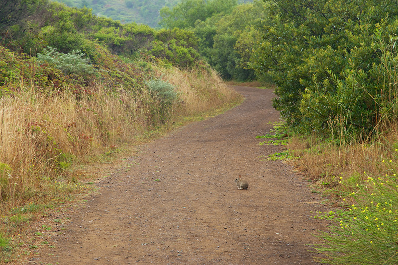
A rabbit on Fox Trail
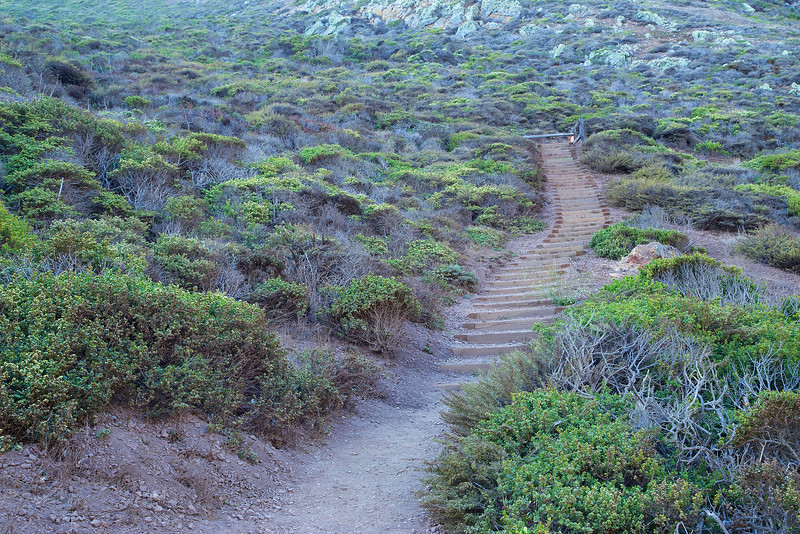
Fox Trail is a climb, and on this hike, is most of the elevation gain in the loop. The early morning, fog was very heavy as I climbed. Often, quail would scurry across the wide, fire road trail. I heard their clicks as they hid in the bushes along the trail.
Mama Quail leading her brood in to the bushes
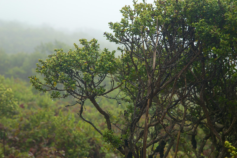
The fog contained a lot of healing moisture. The plants opened up, and drank heavily, becoming more vibrant and green. It was like a very light rain was coming down, and I had to wrap my camera in a plastic bag.
The mist gets thick and heavy, and the plants soak up the much needed moisture.
Secret gardens sprung up in the mist. As I approached the cliffs, I could hear the crashing waves, but not see anything beyond about 30 feet. I knew there were beautiful views of the coast, but they were hidden. Instead, this foggy mist revealed a landscape that hides in the sun and wind of the afternoon.
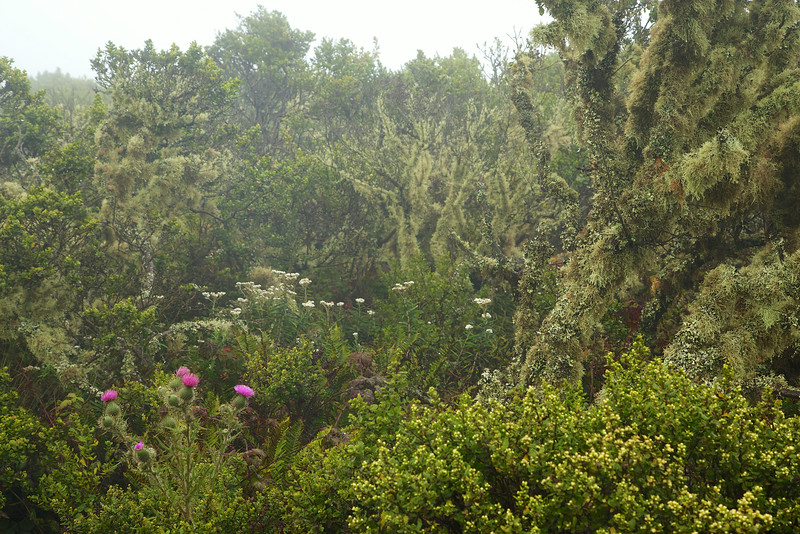
A coastal garden drinks up the fog
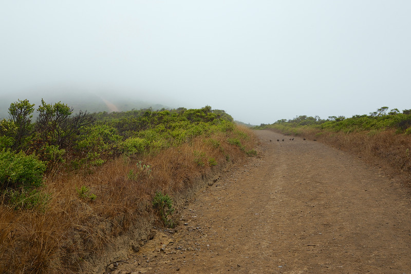
Since the fog hid the views of the coast, I took a left on Coastal Fire Road and started my descent. On the right is a rocky valley, and on the left on the climb down a the steep hillside.
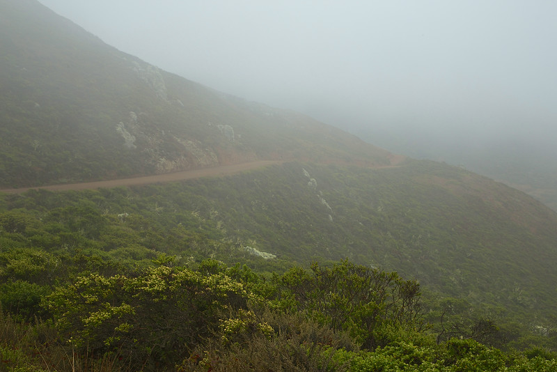
Coastal Trail disappears in to the fog
On the big boulders above and on my left, the lichen were flush with motion and vibrancy.
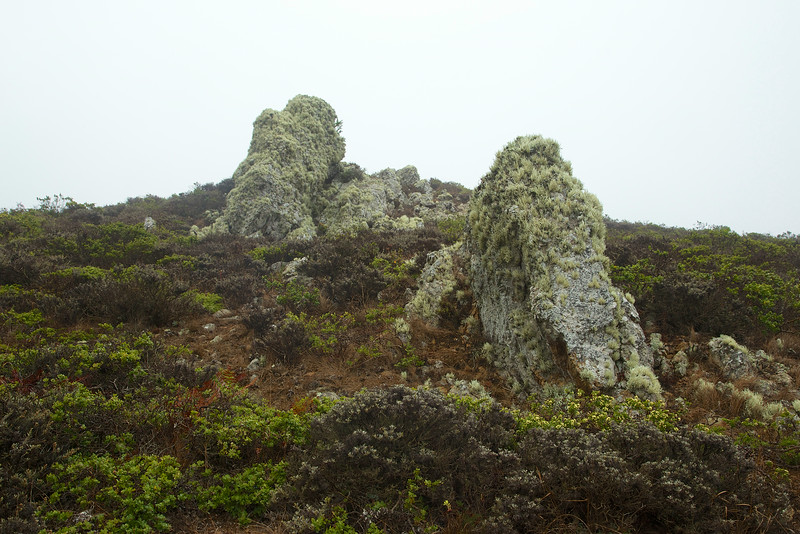
The lichen was soaking up the mist
On the right as I descended, the valley comes in to view.

A teasing glimpse of the valley leading to Tennessee Beach
The beach and valley appear on the descent, and I took a right on to Tennessee Valley Trail and headed to the beach.

Tennessee Beach Trail. The building is a bathroom near the beach.
Just before I reached the beach, I passed a little lagoon with a lone duck.

The Lagoon next to the beach
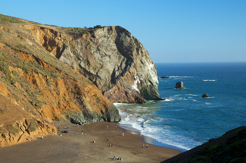
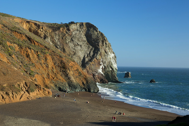
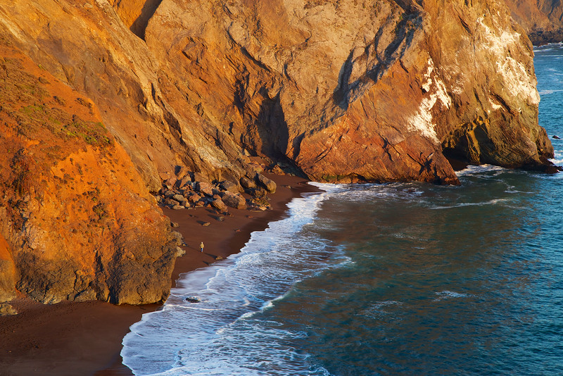
Early in the morning the beach was mostly empty. The waves were slow and gentle, but seemed louder echoing off the giants at each end of the short beach.
If you visit at low tide, you might be able to view the wreckage of the S.S. Tennessee. In 1853, the steamship was targeting the golden gate in to San Francisco, but turned in to Tennessee cove. In the thick fog, the ship was damaged and beached on the cove. The captain managed to save all life, mail and the 14 crates of gold on board.
The Maritime Heritage Project has historical information on the sinking of the ship.
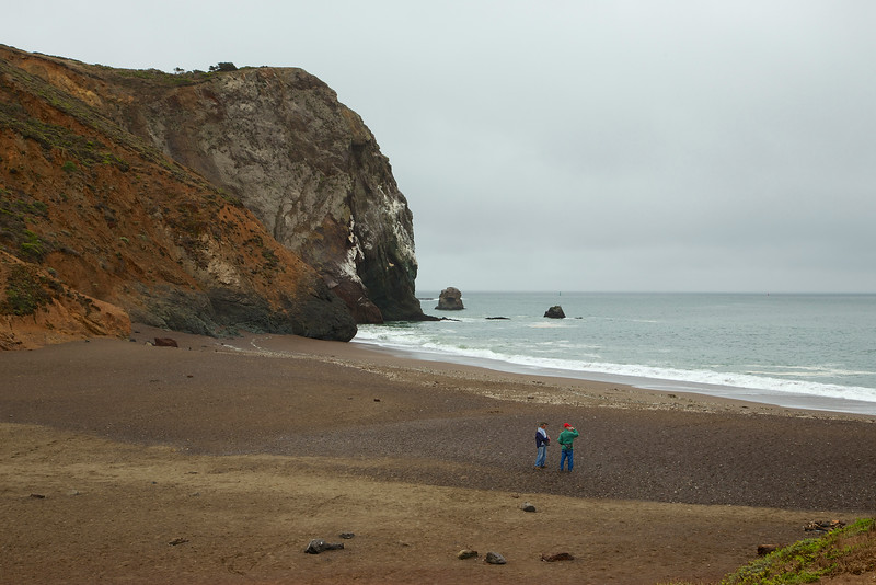
Tennessee Beach on an overcast morning
Standing on the beach and looking to your right, you'll see what to me looks like a sleeping baby elephant resting his head in the water. There used to be an arch across the neck. The arch collapsed last year, and a student was there to capture the event live.
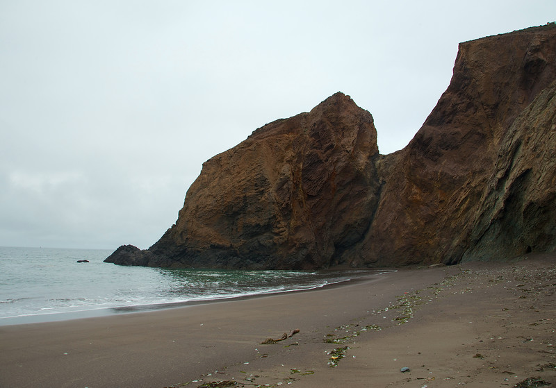
Baby elephant head?
Leaving the beach and the baby elephant, I made my way back to the parking area. The Tennessee Valley trail splits in to upper an lower trails, which merge again after a short distance. The lower trail is a single track trail with access to a few other trails along the way.
Lower Tennessee Valley Trail
Along the Tennessee Valley Trail, you'll see some interesting geological layers in the rock. There is a horse stable along the way, and you'll be able to see, hear and smell it. Parts of the trail are open to horses, so keep your eyes open for gifts along the way.

The exposed wall on the Tennessee Valley Trail
The fog and mist were a beautiful experience, but of course I wanted to see the star of the show, the great California coast.
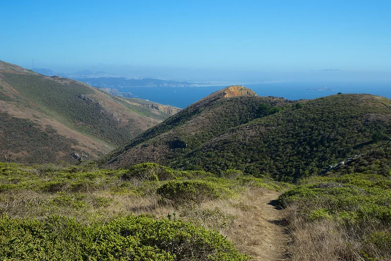
A few days later I returned in the afternoon, with the expectation that I would retrace my route and see what I couldn't see the first time. Hiking up Fox Trail, I could now see the hills, sky and sea, along with circling raptors.
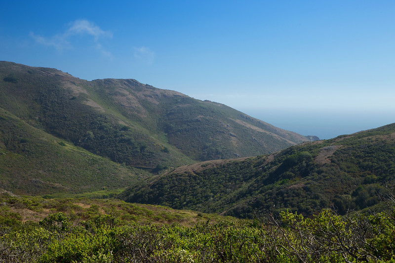
The views open up on a sunny afternoon
This area used to be a ranch, and there are still signs of fencing and barbed wire laying about.

Old fence posts along the Fox Trail, left over from an old ranch
The rolling hills, with a distant view of San Francisco, were once tempting targets for development. In fact, in 1965, developers got approval to build 50 apartment towers, along with hundreds of homes and a mall at the highest point in the hills! Click here to see what might have been...
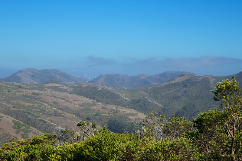
The San Francisco skyline peaks out over the distant hills
Fortunately, a group of dedicated and hard working people saved it for all of us, and eventually the land became part of the Golden Gate National Recreation Area.

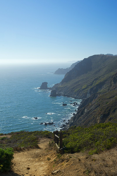
A view of the coast
At the end of Fox Trail, Tennessee Valley can be seen off in the distance.
An off limit trail near the trail split
Going to the right will take you to Pirate's Cove. This is the northern view at the split.
The trail leading to Pirates Cove
I walked a bit down the trail to Pirate's cove. Big, lichen covered boulders guard the trail along the way.
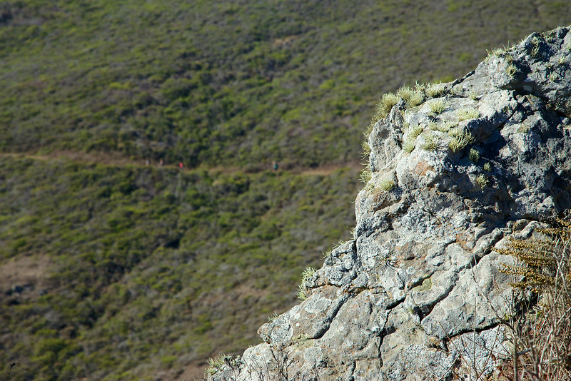
Hikers in the distance
I turned around and headed back to my original route. Looking south, the hills roll a little more gently in to the sea.
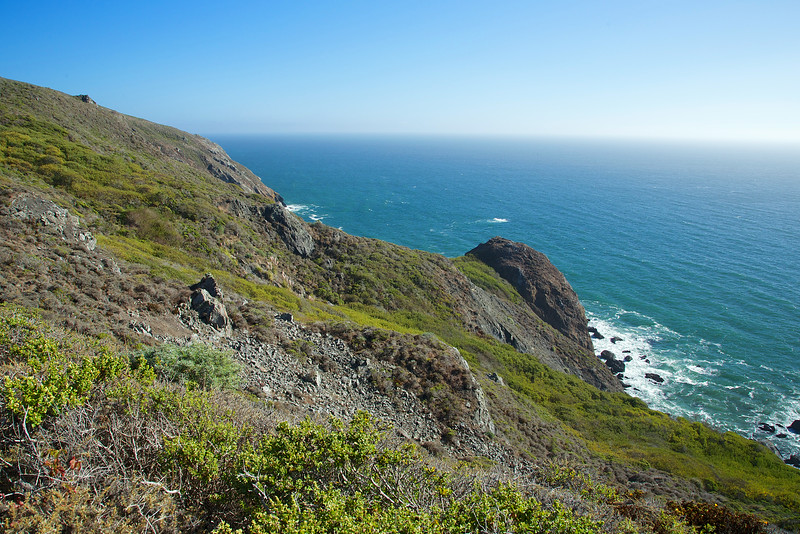
Wild fennel, sagebrush, coastal grasses and other bushes cover the hillside
It was getting later in the afternoon, so I headed to Tennessee Beach. The light and sky were much different from the foggy morning.

Tennessee Valley Trail
I made it to the beach as the sun retreated. Afternoon bathers were starting to head back as the wind and chill picked up.
Tennessee Beach
Up behind the beach are stairs that lead up to an old bunker. Some bunkers in the Marin headlands have been here since the late 1800s, and were built to guard and protect San Francisco Bay.
The steps up to the bunker
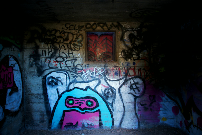
Up at the top of the stairs there was a little room built in to the hillside. The tiny interior was covered in grafitti. At one time, it probably was the living quarters of the bunker lookout.
Inside the sleeping room
At the top of the hill is the bunker. To reach the inside of the bunker, I had to climb down and walk along a very narrow ledge to get to the opening. This is a very dangerous area, with strong winds, narrow walkways and no protective fencing. The edge is a steep drop to the harsh rocks below. I would strongly urge you to avoid climbing in to this area. Instead, look at the pictures I took of the bunker in this gallery.
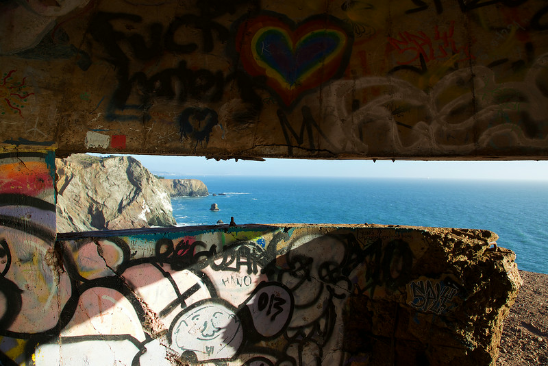
Inside the lookout bunker, looking to the cliffs
Leaving the bunker, I climbed back up and focused on the beach below. I was waiting for the last golden light of the sunset.

Kids playing on Tennessee Beach
As I waited, I watched the waves, the pelicans and distant container ships. Most people had left the beach by now, just moments before the last golden light.
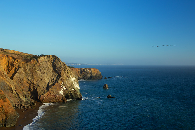
Pelicans taking a trip up the coast
And then, as the sun disappeared and sent one last burst of light, a lone figure walked along the beach.
The golden light of sunset brightens the beach for a lone walker
I took a few moments of video to share the experiences of a foggy, and then sunny Tennessee beach:
Be safe, bring water and enjoy your trip!
Slideshows:
Foggy Morning
Sunny Afternoon
Start at the Tennessee Valley Trailhead
Take a Right on to the Fox Trail
Take a Left on to Coastal Fire Road
Take a Left on to Coastal Trail
Take a Right on to Tennessee Valley Trail
Enjoy the Beach!
Walk back on Tennessee Valley Trail, and take the lower Tennessee Valley Trail
Trails merge, and you'll soon be back to the parking area
NOTICE: This parking area gets crowded on weekends, and you may need to park in one of the limited spaces along the approaching road. To truly enjoy your experience, get there early and avoid the crowds.
Photo Galleries:
Gallery, Foggy Morning Hike
Gallery, Sunny Afternoon Hike
Directions:
Click here for the Trip Planner
To Tennessee Valley from San Francisco
- Go north on highway 101
- Take the Mill Valley / Stinson Beach / Hwy. 1 exit
- Follow Shoreline Hwy. until you see the Tennessee Valley Road sign
- the turn off will be on the left
To Tennessee Valley from the East Bay
- Take 580 west to the Richmond / San Rafael bridge
- Cross the bridge (toll this direction)
- Take the second exit after the bridge, go through Larkspur and get on 101 south
- Follow 101 south, Take the Mill Valley / Stinson Beach / Hwy. 1 exit
- Follow Shoreline Hwy. until you see the Tennessee Valley Road sign, the turn off will be on the left
To Tennessee Valley from the North
- Go south on highway 101
- Take the Mill Valley / Stinson Beach / Hwy. 1 exit
- Follow Shoreline Hwy. until you see the Tennessee Valley Road sign
- the turn off will be on the left