Travemunde and Priwall, Germany

While on vacation, I searched (Googled) for local trails in northern Germany and came across the E9 Trail.  Unfortunately, no one I asked seemed to know what I was talking about.  So, I traveled up to Travemunde and tried to find it myself.  What I found was a nude beach and a few old guys wandering around willing to bare it all in 40 degree Baltic weather.  No, I didn't get shots of them, but I did stumble on a few worthwhile trails.  

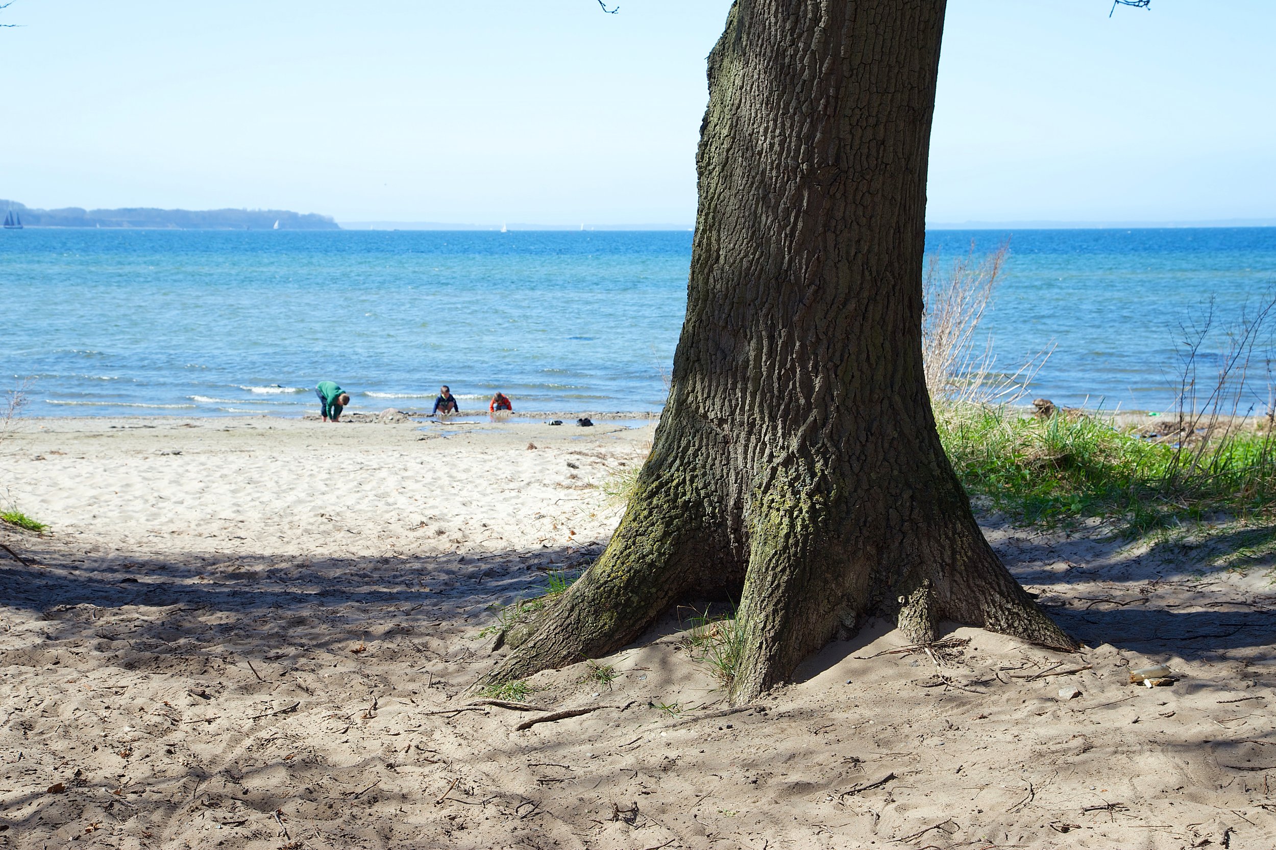
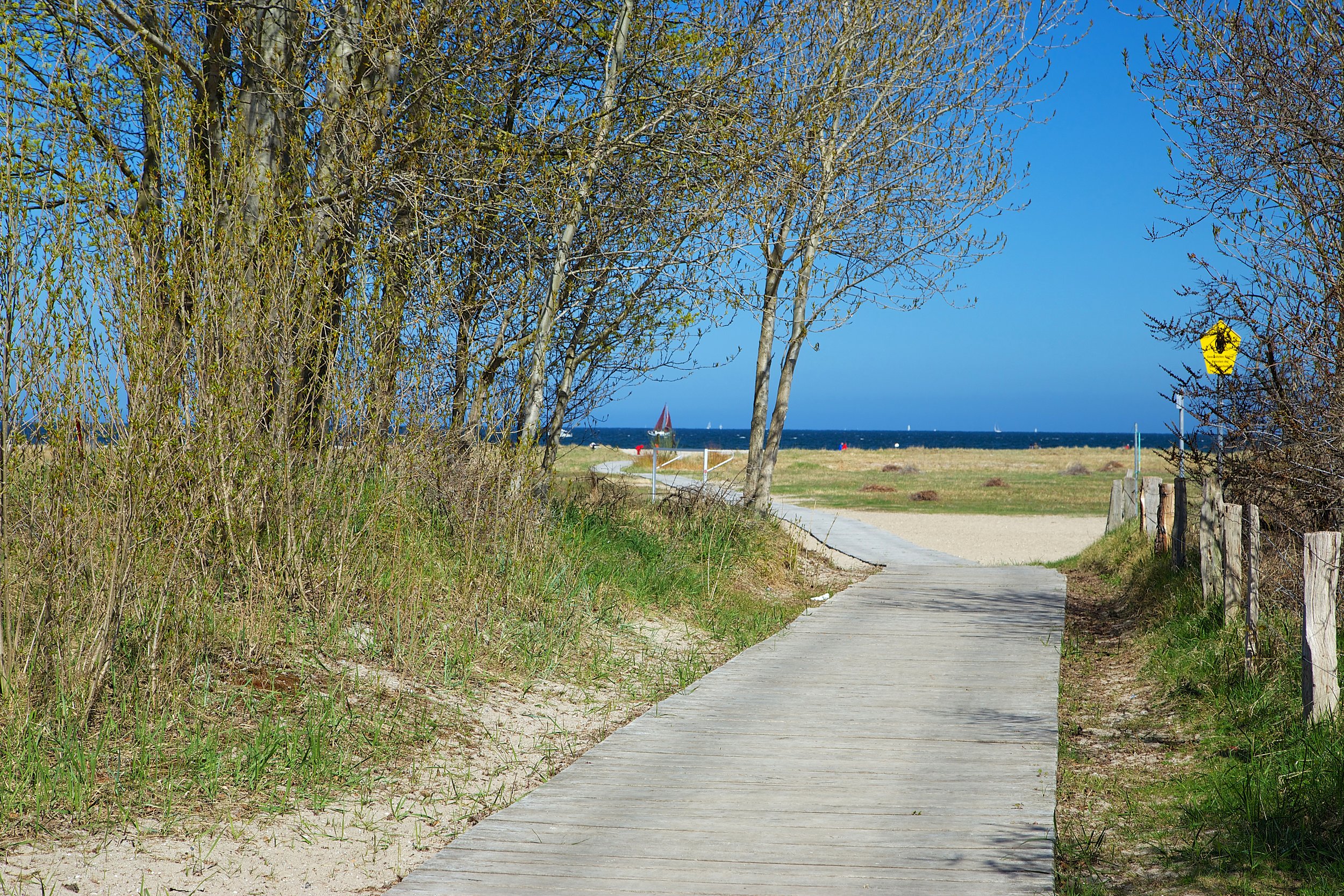
Taking a stroll in PriwallThe Germans love their dogs and their bikes.  It was great to see dogs everywhere, and nobody left their dog poop bags on the trail!  This was not a hike as much as it was a stroll.  The day was cool, but the bright sun had lots of sun deprived northern Germans outside.  I wandered around the little Priwall peninsula for a while.  Priwall is in what used to be East Germany.  30 years ago, when I last visited Eastern Europe, I was retained briefly as a suspected US spy. (No, I was just a naive college kid.)  It was nice to travel here and not be concerned about saying, writing or photographing the wrong things.  

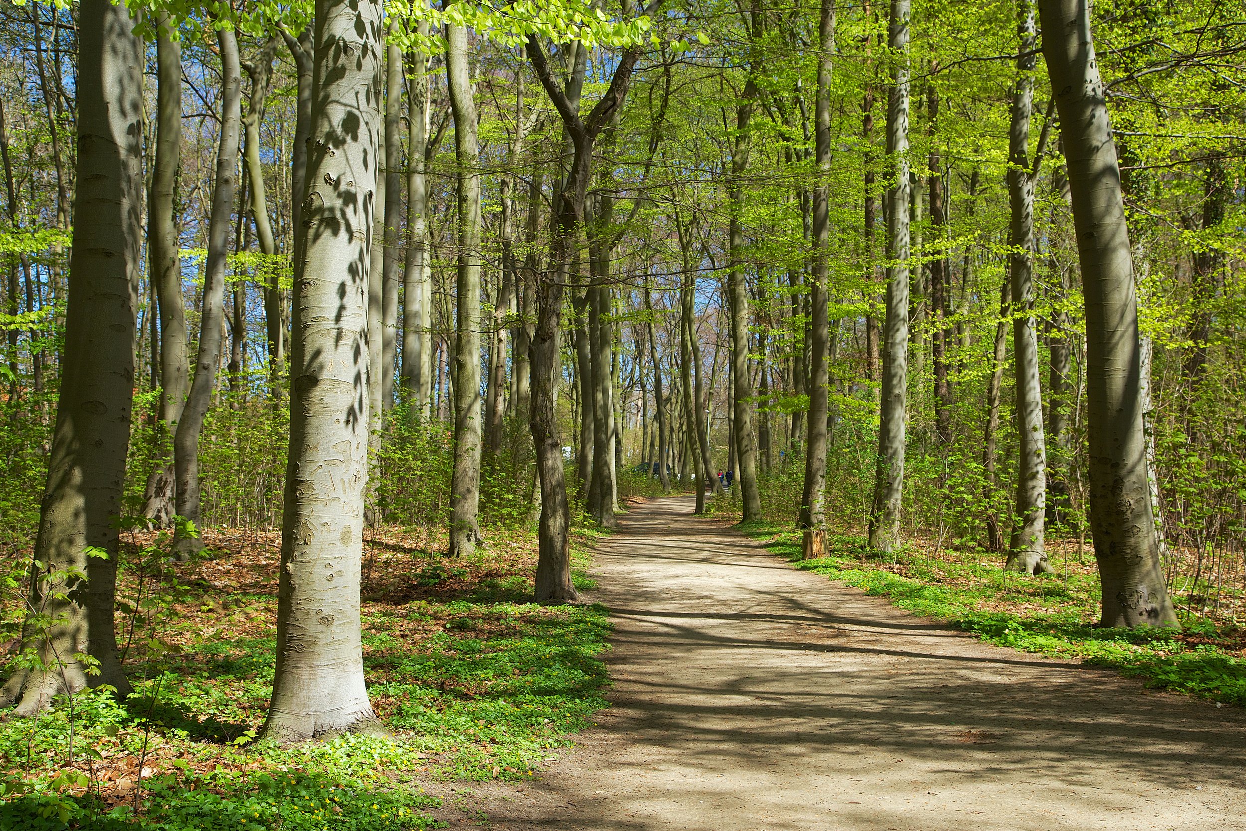
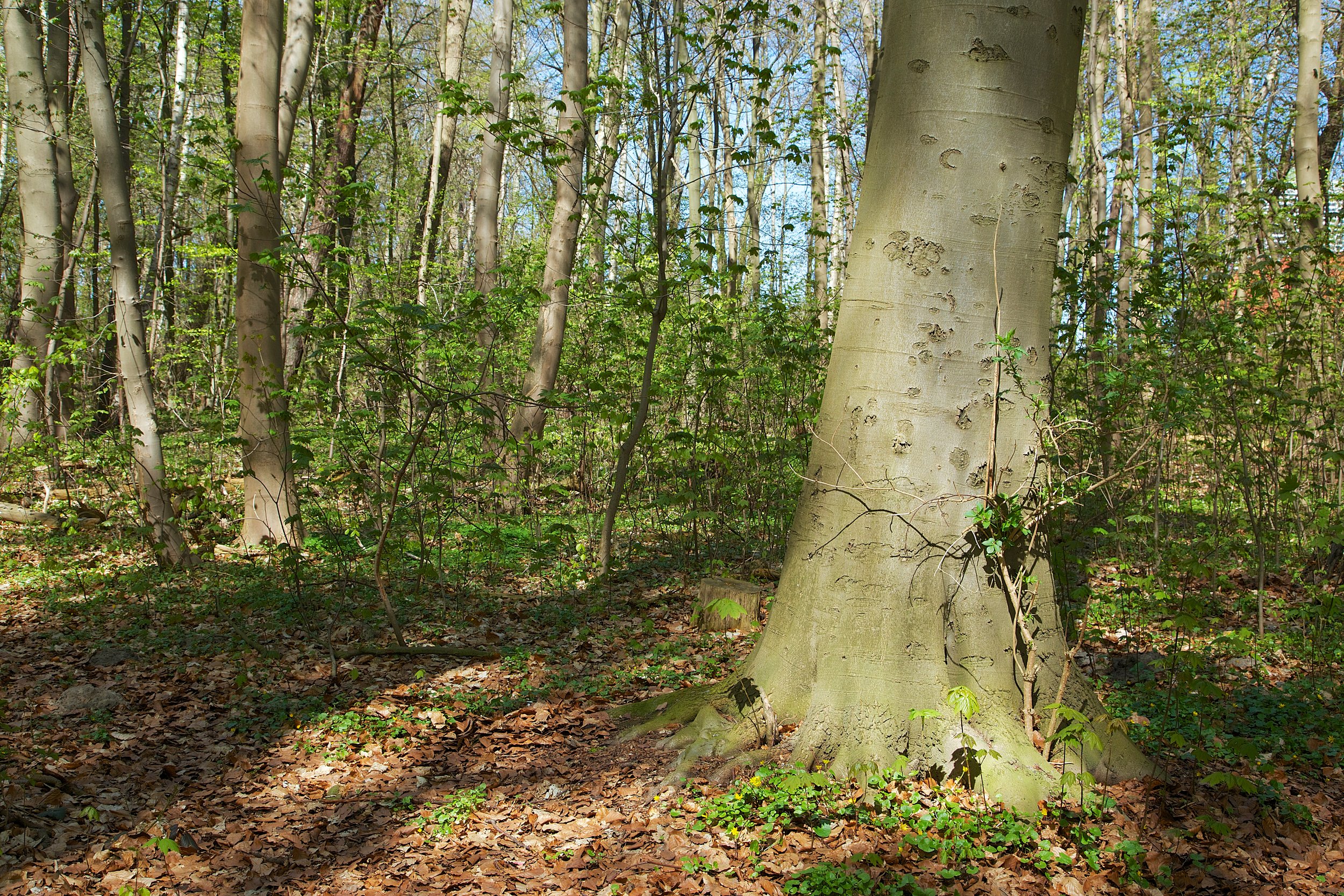
Nice views of the countryside from the trail.So, I wandered around carrying my camera and tripod to the bemused looks of the locals.  The trails were wide, friendly and peaceful.  The trees were just starting to bud with spring's blooms, and the sun's warmth made the walk very enjoyable.  Anytime you are travelling, take some time to find local trails.  

Bikes are more common than hikers on the trails.

I'm looking forward to the Calfornia Trails conference this week.  My session will be Thursday morning at 9:45, if you can attend.  See you there!

Redwood Regional Park - Spring 2013 - Valley Scenes

This winter has been dryer than usual.  I visited Redwood Regional Park on April 6th to take some pictures of Redwood Creek and the feeder streams, but found them to be dry or flowing very lightly.  Luckily, the light was perfect.  It was actually raining, and I had to keep a large bag over the camera to keep it dry.  These are some scenes of Tres Sendas and French Trails.  

One of the best places to enter the park is via the

Moon Gate off Skyline Blvd.

   There is not as much parking here as the Skyline gate staging area, but Tres Sendas Trail is right off the Moon Gate.  Start at Moon Gate, and take a left on the West Ridge Trail.  You'll pass a few houses on your left as you make your way to the trail.  Tres Sendas Trail is on the right.  This trail drops you in to the valley of Redwood Regional Park.  

Print off a map

before you go, because there is not a map stand at this trailhead.  

Full Gallery

Trail Maps

(Get the maps for Redwood Regional Park)

Prints

The rain made the moss and foliage much more vibrant

View of the Redwoods across the valley floor

A wet mist added a bit of atmosphere...


Redwood Regional Park 14.jpg

Redwood Forest

Redwood Regional Park


Roberts Regional Recreation Area

Roberts is a small park (just 82 acres) but contains a lot of beauty and variety.  It's also one of the cleanest, most accessible parks I've visited.  It's a great place to introduce young children in to hiking and nature, because if they get tired of the trees there is a big and new looking playground.  But, nothing can compete with the natural beauty just steps from the parking area.

These Redwoods are next to the parking area.Wide and tranquil trails surround the park.Starting out, I accessed the Graham Trail on the east side of the park, and headed south.  The trail is wide enough for people to walk and have a conversation side by side.  It's a great place for walking with friends.  

Views of the hills as you hike along Graham TrailI hiked until I reached the intersection of Graham and Dunn Trails (.61 miles), and then I turned around and headed back towards the park.  There was a light amount of trail traffic, especially people with dogs.  

This park abuts Redwood Regional Park, and if you stay on Graham Trail on your return and walk past the park, you'll reach West Ridge Trail.  Taking a right on West Ridge will take you in to Redwood Park, but I took a left for a short walk on the West Ridge Trail and then a quick left on to Roberts Ridge Trail.  Redwood Bowl is right in this area, and the trail is quite beautiful here.

Wander around here, but don't forget your map.  Get the Roberts and Redwood maps in case you want to venture in to Redwood Park.  

I took this hike in the late afternoon, and as the light started to fade, I went back in to the Roberts Grove.  

There are several monuments in this park.  There is a marker for a fallen Redwood whose planks and timber lined the walls of unknown numbers of Bay Area buildings.  This tree was so massive that sailors in the bay used to use it as a navigation point.  Also in this spot is a bench and marker honoring the all volunteer "E Company" unit of WW2.  This unit was composed of Japanese Americans that had been interned in US prison camps, but volunteered to fight and become the most decorated unit in WW2.

As the light was fading, I visited the short Manzanita Loop Trail, which has a nice bench and views of the hills and Mt. Diablo.

Take your time, bring the kids and enjoy this beautiful place.  There is a $5 fee for parking, clean bathrooms, picnic tables, a children's park, pool and open fields.  Get there early on weekends.

Enjoy and be safe!

Park Page

Trail Map (Roberts Regional Recreation Area)


Roberts Regional Park 12.jpg

Roberts

Roberts Regional Recreation Area

Don Edwards San Francisco Bay National Wildlife Refuge

Don Edwards Wildlife Refuge is the first urban national wildlife refuge in the US, and is the home and/or habitat for thousands of migratory birds and other species.  I visited the park twice, once in the late afternoon, and then early morning on another day.  I wanted to see and experience the variety of wildlife at different times of the day.

Website

Freemont Trail Map

Trail Map near education center

Directions to Refuge

On my first visit, I arrived late in the afternoon.  Parking was easy, and there were a reasonable number of visitors starting or finishing their hikes.

I started out on the La Raviere Marsh Trail.  I quietly watched a Snowy Egret hunting, and patiently waited as he searched for his dinner.

What's for dinner?You can spend some time in this little marsh, and if you're quiet, you'll see a great variety of birds hunting, nesting and just floating around.  

Next, I crossed the road and went over to the Tidelands Trail.  

Looking up at the hill, I saw a burrowing owl fly by quickly.

He was quickly followed by a Turkey Vulture.

As you wander the Refuge, you'll cross marshes on a variety of bridges, giving you a better chance to see some wild birds.

This is a place to wander.  Bring a map and explore the grounds.  There is a visitor center, an amphitheater, and benches located along the trails.  As always, bring water.  

Black-necked stilts

As the afternoon light faded, I came across some Dowitchers feeding.

And further explored the marsh.


I decided to revisit the refuge to see if I would find different birds and different light.  It was an overcast morning, with intermittent rain.  That gave me some nice light to get a few pictures of the trails.

Poppies were in bloom..

Bridge across the marsh

Of course, I wanted to capture some more images of the local population.  I came across a Snowy Egret hunting and fluffing up.

Just about to strike...look at the intensity in the eyes.I continued on in the LaRaviere marsh, where the bridge has some interesting lines.

And I passed a couple of geese and a duck, who posed for me.

This is an interesting place.  You'll see birds that you would never see in your back yard, unless you live near the water.  The trails are not too difficult to traverse, and they are well populated. The brochure recommends visiting during an outgoing tide to see birds in the mudflats, and during high tide to see more birds in the marshes.  Here is a tide chart to help you out.  If you have binoculars, bring them.  If you're there for photography, a lens range between 200-600mm is good for birds, and wide angle lens would be great for landscapes.

Enjoy, be safe, and have fun!


Don Edwards AM 62.jpg

Morning Scenes

Don Edwards National Wildlife Refuge


edwards 2_LND1382.jpg

Afternoon Scenes

Don Edwards National Wildlife Refuge

McLaren Park, San Francisco

Tucked away in the southeast corner of San Francisco, McLaren Park is a 312 acre park with a lot of beauty and variety.  Trails abound throughout the place, and you'll wander through little groves of Redwood, Eucalyptus, and Cypress.  

Many of the trees were planted in 1927, during the dedication

None of the trails visited were marked.  This is more like a wandering park, where trails appear and disappear almost everywhere you look.  It's also a dog friendly park, so you'll see dogs everywhere.  Owners and walkers seemed to be in control of their packs, and cleaned up after their dogs.    

Time for a bath

Take my picture!

Because the trails are unmarked, you find yourself wandering through a variety of canopied trails and over rolling hills, and this exploration is interesting and enjoyable.  Add the typical morning fog, and you add an element of mystery and drama.

Benches on some of the trails give you a place for some relaxing contemplationSome of the trails are narrow, single track, while others are paved and wide

McNab Lake is a hangout for a variety of water birds and a nice place to enjoy a picnic lunch.

Because of its urban location and convenience, McLaren Park is a great place to introduce young people to nature.There were a few professional dog walkers there, and some individual hikers, but the place was quiet.  I can imagine that it would be crowded on a hot, summer weekend, but on an early weekday morning, it's a great place for a stroll.  

Peaceful little Redwood grove

You can keep to paved trails, escape on to little side trails, or just sit on a bench and relax.  Take some time out of your day to visit this little patch of nature.  You'll leave rested and refreshed.

Trail Map

San Francisco Trail Map (I picked this up at REI, but you can order from the website.)

YELP Reviews of McLaren Park

SF Parks Page


McLaren Park SF 3 14 13 32.jpg

McLaren Park

San Francisco, California


Trailhead