Sunrise Trail Loop Hike, Briones Regional Park

I had a wonderful hike on Saturday that surprised me with beautiful canopies and spectacular views of Mt. Diablo poking out from an ocean of fog.  Even though it was 36 degrees at the start of the hike, the nice ascent of the Sunrise Trail will bring out the heat in you.  

Mt. Diablo rising up from the fog

  • LocationBriones Regional Park
  • Route: Starting at a secluded trailhead at the end of Springhill Road, you'll pass through the first of many cattle gates you'll encounter.  You'll see the first trail marker, which will point the way to the Buckeye Ranch Trail.  You'll shortly pass through another cattle gate, which will take you on the beautiful, canopied section of this trail.  The sun was streaming in through the trees when I went, and the only sound was the occasional Jay squawking about my disturbing their morning.  

Sun streaming in on the Buckeye Ranch Trail

This was a nice, peaceful forested trail, loaded with moss covered Oaks and Bay trees  There was a dry creek bed to my right, but during a normal winter that should be flowing nicely.  

You'll soon come to a Y split.  To your right you can access the Sunrise Trail.  But, keep to your left, as the Buckeye Ranch Trail will loop you back, and you'll want to enjoy a little more of this canopy.  There are quite a few trees and groves with a lot of personality.  Keep an eye out for this old giant that probably lived over 200 years before it collapsed:

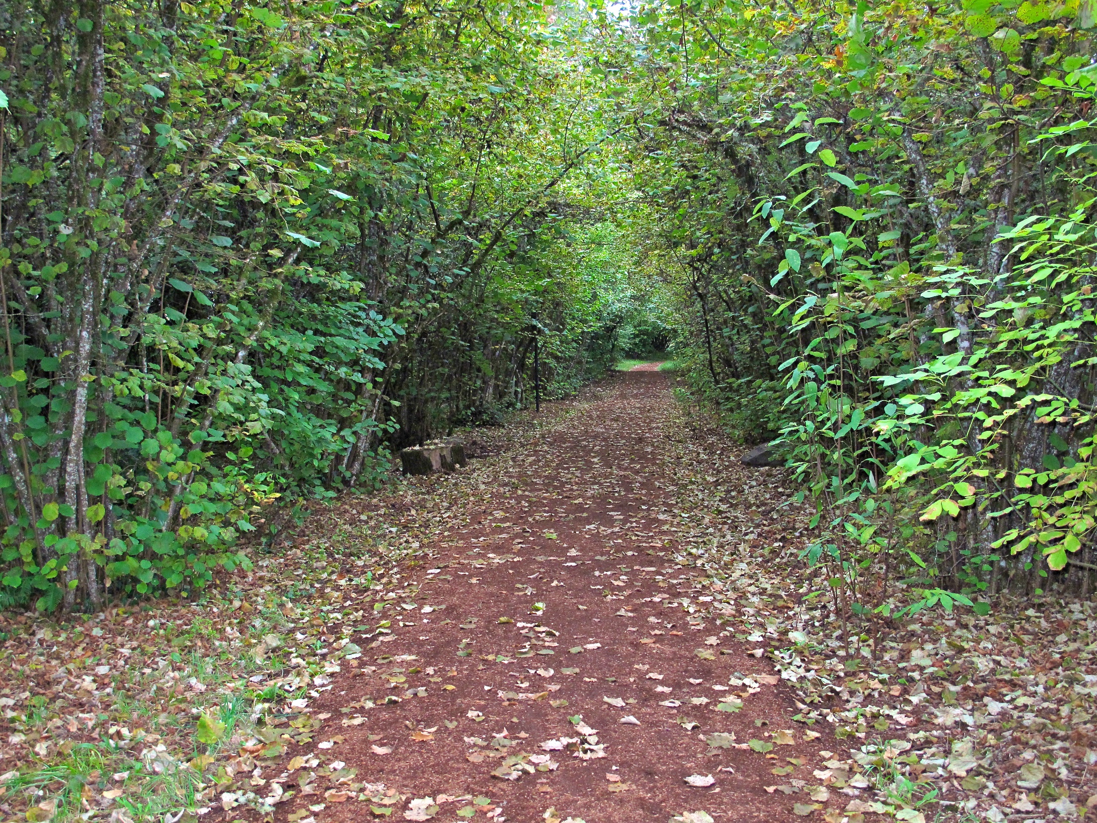
As you loop back, you'll go through one more gate.  Make sure you close all the gates completely, because there were a few cows lounging around in this area. At one mile, you'll see the sign for the Sunrise Trail.  Go straight here, and soon you'll be wandering through this little cluster of oaks:


I came across the remains of a cow here, with signs that some nocturnal visitors had already started feasting on it.


Sunrise Trail is a climb, and this is where you'll start to feel your quadriceps tingling and your heart knock on your ribs.  You'll climb out of this little valley to follow a ridge line up along some rolling hills.  

 On the morning of my hike the fog was heavy, and at this point I could see it still hanging around in the valley below me.  

Keep climbing, keep climbing, you've got a ways to go.  But as you climb, keep turning around to check out the view.  

At 2.65 miles, you'll come to the Briones Crest Trail.  Take this trail through some nice oaks, and enjoy the shade for a while.  It's a nice spot for a PBJ and an iced tea.  

It seems like I always make a few bovine friends on these hikes, and this crew was pretty cordial:

At 3.53 miles, you'll take a left on to the Lafayette Ridge Trail.  The curves of this trail looked like a giant anaconda resting in the California sun.  

At 3.66 miles, take a left on to the Buckeye Ranch Trail. Follow this trail through a few more scenic groves, and you'll come to the Sunrise/Buckeye Ranch Trail split.  This time, take a right to the Buckeye Ranch Trail and follow that back to the trailhead.  

  • Mileage: 4.73 miles, 
  • Difficulty Level: Moderate due to climbs, but mostly easy
  • Description: Refreshing hike through oak woodlands, offers great views of surrounding areas and Mount Diablo.
  • Trail Map
  • Trailhead and Parking: End of Springhill road, Lafayette.
Sunrise Trail jpgs 12-17-11 37.jpg

Sunrise Loop Hike

Briones Regional Park


Kennedy Grove Trail Notes

Kennedy Grove is a beautiful surprise.  I visited the park on a cold, wet November morning.  Rainy skies usually provide the best light for photography, but it's tough to keep the camera dry.  When I got there, it was just me and the ranger in the park.  I was most interested in the trails around the recreation area, but it's a beautiful setting for picnics and gatherings.  

Picnic area at Kennedy Grove

The Eucalyptus trees in this part of the park were planted in 1910.  These trees grow fast, and as you can see above, they're huge.  

Full Photo Gallery

Location: Kennedy Grove Regional Recreation Area

Directions

Trail Map

There is a fee for parking and dogs.  

It wasn't raining when I got there, but started as soon as I got my camera out.  I pretty much had the place to myself, but I imagine this is bustling in the summer. Right off the parking lot, I got on to the Laurel Loop Trail.  This is a wide trail, and it runs along the side of the lawn area.  

You'll pass some of the Eucalyptus giants on this trail.  I have mixed feelings about these trees.  They are quite impressive, but they're non native and often poison the soil below them.  The one plant that does seem to like them is poison oak, which is often found wrapped around the base of these trees.  

After walking the Laurel Loop Trail, you'll see a sign that will guide you to the Lower Sea Foam Trail.  By taking the Lower Sea Foam Trail, you'll be able to get some spectacular views of San Pablo Dam the the reservoir.  At .70 you'll access the Lower Sea Foam Trail.

My GPS watch that tracks my elevation gains could not connect with a satellite, but the Lower Sea Foam Trail is a bit of a climb.  I had the added weight of a few pounds of mud on my boots.  

On this part of the hike, you'll go through mostly shrub, and the path becomes a single track trail.  

As you hike, make sure you enjoy the views of the San Pablo Reservoir.  

At 1.05 miles, I connected with the Upper Sea Foam Trail.

This continues your climb, but it is incredibly rewarding when you reach the top.  The sight of a beautiful Oak grove took my breath away. 

Take some time up here, and look at the incredible twists and contortions of these old trees.  There are a couple of beauties with some real personality:

Follow the Upper Sea Foam Trail as it winds downhill through a dense army of Oaks that seem to reach out to you like green ghosts.

As you descend down the trail, you'll see more Bay trees, and the whole atmosphere, especially in the rain, reminds you of a scene from middle earth.

Follow the trail down to Kennedy Creek Trail, and take a left to head back to the picnic and parking area.  There are still a few beautiful sights in this section.

You'll walk back to where you started, and you can tell your friends that they should have joined you on this hike. The total distance hiked was 2.28 miles, but be prepared for the climb to Upper Sea Foam Trail.  Have fun, and be safe!

Photo Gallery:

Rocky Ridge Trail Notes

The Rocky Ridge trail has been on my "to do" list for a while.  Certain parts are quite remote, but it offers beautiful views and a stunning grove of twisted and contorted Oaks.  


  • Location: East Bay Mud South Watershed
  • Route: From Rancho Laguna Park, go through the gate on the right side of the parking area, facing away from the lot. Follow the signs to the Rocky Ridge Trail, to your right. 
  • Mileage: 6.01 miles, 1200' elevation gain
  • Difficulty Level: Moderate to strenuous. The entire loop hike is 11.2 miles. Hike as far out as you choose, but realize that you have to return the same distance. Turn around while you still have strength in your legs. 
  • Description: Notes below
  • Trail Map
  • Trailhead and Parking:
 

There are a lot of cows in this hike.  Starting out at Rancho Laguna Park, sign in at the station before the hike. Click on the Permit link to get a permit from East Bay Mud.  

You'll hike up to see some peaceful rolling hills, usually dotted with cows.  Follow the signs to the trail.  At .40 miles you'll come to a split where King's Canyon Loop Trail and Rocky Ridge meet, so keep to your left and hike along the fence.  You may see these trail sentries:

At .77 go through gate and get past this group of cows.  You'll enter in to a beautiful grove of Oaks.  In the winter, this next section has a nice stream through it.  This area is particularly lush during the winter and spring. 

At 1.14 miles, you'll leave this part of the forest and get on to a ridge trail.  There will be some nice climbing in this area.  You'll end up going through another cattle gate, and start a descent in to a valley.  

At 1.84 miles, you'll see where the trail leads to your left, on to a fire road type trail.  As you hike on this trail, you'll come to this sign:

It's confusing here.  The sign looks like it's pointing to stay on the fire road, but it's actually indicating a trail off to the right.  So stay to your right.  Not knowing this, I enjoyed a little detour up this trail to a locked gate, then doubled back to this point.  

I continued on this trail for just over 3 miles.  At that point, I took out a few slices of pizza and an ice tea and watched the hawks circle lazily above me.

I returned back to Rancho Laguna via the same route.

Don't let the remoteness of this trail scare you away.  It offers nice views,  some great Oak forests and a wide variety of wildlife.  

Have Fun!

Photo Gallery:

Alton Baker Park and Pre's Trail

Steve Prefontaine was an American middle and long distance runner, who inspired millions with his efforts and successes.  He won the NCAA Division 1 cross country championships three times, and made the cover of Sports Illustrated when he was just 19.  

While travelling in Europe, he was inspired by the style of the trails, and encouraged local officials in the University of Oregon college town of Eugene to build a similar trail.  The trail was finished just 4 months after his early death in a car accident.  His legacy continues on this beautiful trail, which is a must visit for any runner going to Eugene.  

Official Website of Alton Baker Park

The trail is located in Alton Baker Park, next to the University of Oregon's Autzen stadium.  Much of the trail is covered in bark chips, and winds through the beautiful forests around the stadium.  As you run on this trail, you'll notice how pleasant and soft the trail feels on your feet, and it gives a surprising bounce to each step.  

If you have the good fortune to be visiting Eugene, take some time to run on this trail.  It's a very rewarding experience. 

  • Location: Alton Baker Park, Eugene, Oregon
  • Route: 
  • Mileage: 4.07 miles
  • Difficulty Level: soft, easy level surface makes you feel like you're floating as you run
  • Description: The bark mulch surface softens the trail, generating less impact on the joints as you walk or run. Enjoy the experience of this trail and meet many friendly runners and walkers looking for the same thing.   
  • Trail Map
  • Trailhead and Parking:
 
Alton Baker Park - Pre Trail 8.jpg

Pre's Trail

Alton Baker Park


Trail Images:

Hike to Brittle Leaf, Anthony Chabot Regional Park

The hike to the Brittle Leaf Trail takes you to a nice bench among the Manzanitas, and a beautiful view of an Oak filled canyon.  

  • Location: Bort Meadow Staging Area, Anthony Chabot Regional Park
  • Route: From the staging area, follow MacDonald Trail 1.14 miles to Broken Leaf Trail. Take a right on Broken Leaf Trail, and walk through the forest .14 miles to the bench, and enjoy soaring birds and the view. 
  • Mileage: 2.6 miles round trip, 804 feet elevation gain
  • Difficulty Level: East, some climbs on a wide fire road. Brittle Leaf is a short single track trail. 
  • Description: Nice lazy day hike for conversation or solitude. Runners, hikers and bikers abound on this trail. 
  • Trail Map
  • Trailhead and Parking: Bort Meadow Staging Area

From the Bort Meadow staging area, take the MacDonald Trail, off to your right as you face the valley.  Before you start, look up over the valley and you'll probably see hawks circling, looking for their next meal.  The valley below contains the Bort Meadow/Big Trees group camp, which is used by groups for picnics and overnight camping.  

Go through the gate and start your hike. 

The MacDonald trail is a wide, fire road trail, popular with mountain bikers and trail runners.  It's got some ruts and minor channels from past rain runoff, so be careful with your steps.  

As you hike, you'll notice some nice clusters of Oaks on your right.  

At about 1.23 miles, you'll reach the Brittle Leaf Trail, on your right.  

You'll have a very short little hike down a narrow path to the end of the Brittle Leaf Trail.  No bikes are allowed on this trail (it's very narrow and a bit overgrown).

At the end of the trail is a bench, with beautiful views across and oak studded valley.  

You'll be sitting in a Manzanita grove, so take some time to look at these unique and beautiful shrubs.

When you're ready, head back up the Brittle Leaf Trail to the MacDonald Trail, and take a left.

Follow the MacDonald Trail downhill back to the staging area.  About half way back, you can sit on this bench and watch the hawks over the valley.

Going to Brittle Leaf Trail is uphill, and the return trip is all down hill.  This hike won't take you long, especially if you run it.  But it's a perfect Sunday morning stroll, especially if you get there early.  Enjoy!

Hike to Brittle Leaf Vista 65.jpg

Hike to Brittle Leaf

Anthony Chabot Regional Park


Images