
Short loop hike with extensive views of the Carquinez Strait
Read MoreCarquinez Strait Regional Shoreline, October, 2014

Short loop hike with extensive views of the Carquinez Strait
Read More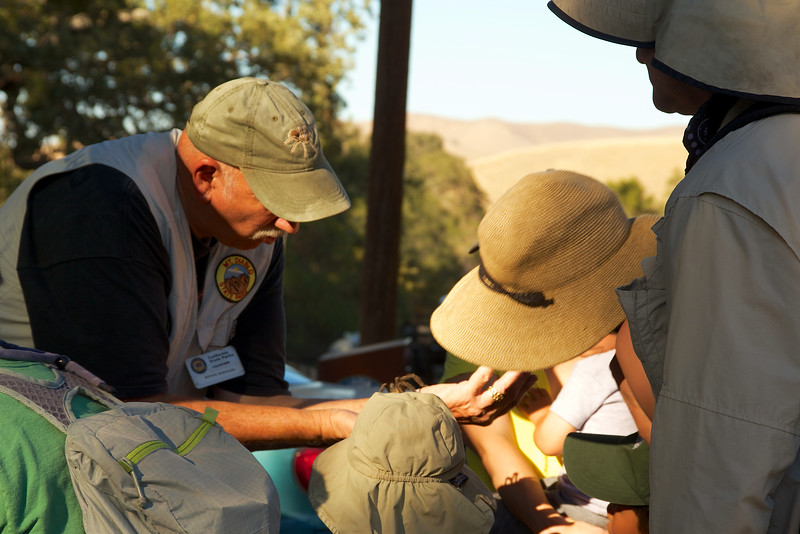
Naturalist Michael Marchiano introduces us to his friend.
Some people might have developed a fear of tarantulas from scenes like this in an old James Bond movie, but as Save Mt. Diablo naturalist Michael Marchiano explained, Tarantulas are mostly harmless to humans, packing just enough venom to paralyze a cricket or small insect.
October is usually mating season for Tarantulas, so Michael and Save Mt. Diablo organized a tarantula hike to help people better understand and protect them. These beautiful and delicate creatures usually make their mating appearance on local trails in October. However, the drought pushed them to appear starting in late July. The males have been hiding and growing. When they shed their exoskeletons one last time, after about 5-12 years, they head out like little ninjas, looking for a mate. They have to be stealth, because there are many predators looking for them. Their main weapon is their microscopic hairs, which they can shoot off in to the eyes of attackers.
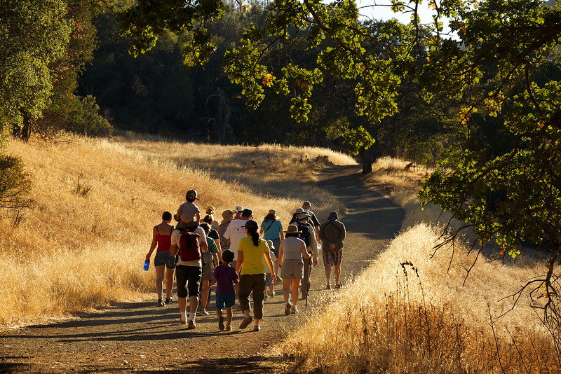
Michael leads the hikers to find Tarantulas.
To find tarantulas, we met at the Mitchell Canyon staging area, and we started the hike on the Mitchell Canyon Fire Road. We eventually followed the Blackpoint Trail for a little bit, before retracing our steps back.
As we hiked, I noticed that the trails were dry and dusty, just like you'd expect at the end of a hot summer. The grasses were baked, and the oaks looked weary and fragile. It was hot, even in the late afternoon, and a few flies buzzed us as we marched up the trail. There are quite a few grey pines along this part of the trail. Their red bark stood out among the golds, browns and dull greens of the late fall.
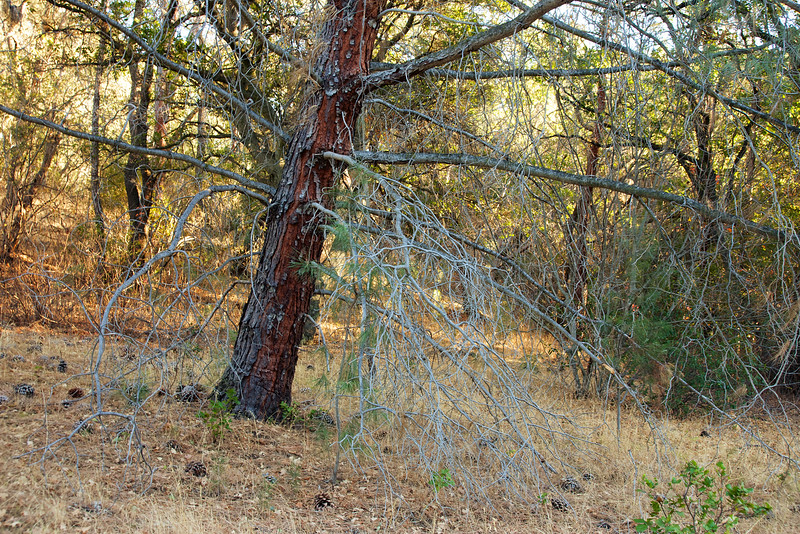
Grey Pine
We were looking for female tarantula burrows. Michael described what they looked like, and soon we found one. The females nest in burrows in the ground, about 12-18 inches deep, and line their holes with a silky mesh. During the mating season, the male tarantulas roam until they find a burrow. They taste the silky web, and if the taste indicates a mate ready female, the male taps on the delicate threads.

Female Tarantula burrow
About 20 minutes in to our hike, after having seen a number of female burrows, we came across a lone male tarantula in the middle of the trail. With a good number of hikers marching up and down the trail, this little guy might have been in danger of being stepped on. Just getting to this point in his existence, he's survived long odds. Born the size of a pinhead, in a brood of hundreds, he's overcome predators, and his own hungry siblings, to have a chance to mate.

Tarantula Paparazzi
We gave him enough space to find a female, but his spider sense told him to keep moving. We watched him take a look around and then scurry back to the relative safety of the brush right off the trail. Click here to see how tarantulas mate. The male risks getting eaten by a hungry female after mating. If he manages to escape that fate, he has other dangers lurking besides the heavy boots of hikers. The female tarantula hawk can swoop down and paralyze the wandering tarantula with her sting. She then drags the immobile but still living creature in to dark burrow, where she deposits an egg on his abdomen, and then buries him alive. The paralyzed tarantula can live up for six months without food. But after approximately one month, the tarantula hawk larva hatches. It knows to eat the tarantula from the outside in, leaving the vital organs for last, so the food will stay fresh. But, nature's pull to find a connection and mate drives the male to take all these risks. And off he goes, a gladiator for love.

Male tarantula looking for love.
I watched the little guy safely disappear in to the scrub as we continued our climb. His search was not over. Male Tarantulas can roam as far as several miles in search of a mate. For this guy, after years of living in a dark cave eating bugs, even the risk of crushing boots, the sting of a tarantula hawk or the powerful jaws of a raccoon won't slow him down.
While we didn't see any more male tarantulas, another gift appeared. Light from the setting sun was just starting to touch the hills across the valley. Mitchell Rock was dark in the foreground, but the hills glistened like a giant treasure chest.

Setting sun on Mitchell Rock
As the sun was disappearing, the moon showed up early. There was an epic show down, and the moon eventually won the battle. The sun bowed and begin to slip away, but not without sending a last generous burst of warmth and color.

As we walked back down the trail, the last of the golden light flashed across the distant east bay hills. In the deepening shadows of the grey pines and live oaks, we stepped carefully, knowing that a gentle and amorous tarantula might be right around the corner, waiting for his moment...

Returning to the trailhead.
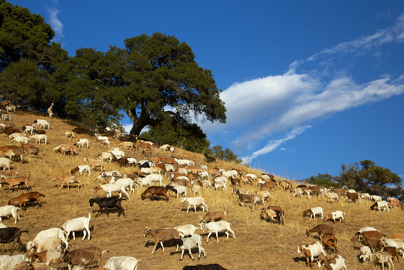
Goats along the Oursan Trail
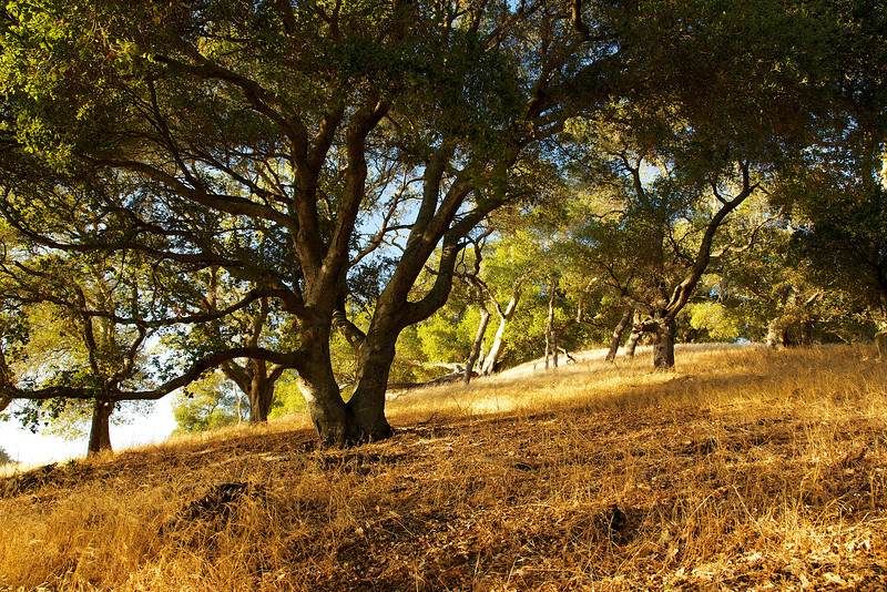
I wanted to take a walk along the water and watch the sunset, so I went to the Oursan Trail on Saturday afternoon. I knew it was a great place to hike, contemplate, and capture the light and colors of the fall sunset. I thought a walk along the Briones Reservoir might be a nice and quiet experience.
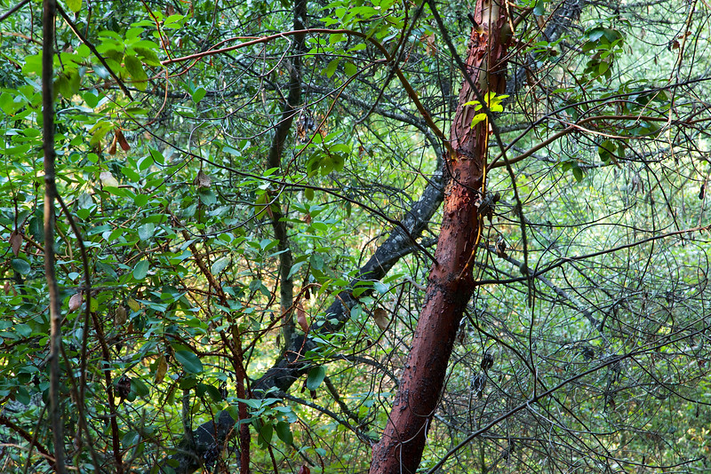
A young Madrone stands out in the forest
I saw the goats from the road as I was approaching the trailhead. You could see them rampaging the brush as they fed. I parked and hiked about a quarter mile up the trail. They were right around the first bend.

"Please," she said, "send me a copy for my kids..."
East Bay Mud, our local water utility, uses the goats for weed abatement, instead of poisons or weed whackers. The goats were curious about me, but after they posed for a few shots, they went back to their chomping and grinding. Then, they made a quick migration across the hillside.
They were surrounded by an electrical fence, which was being tended by a herder. His little helper was quietly resting in the shade.

The Goat Herder's pup
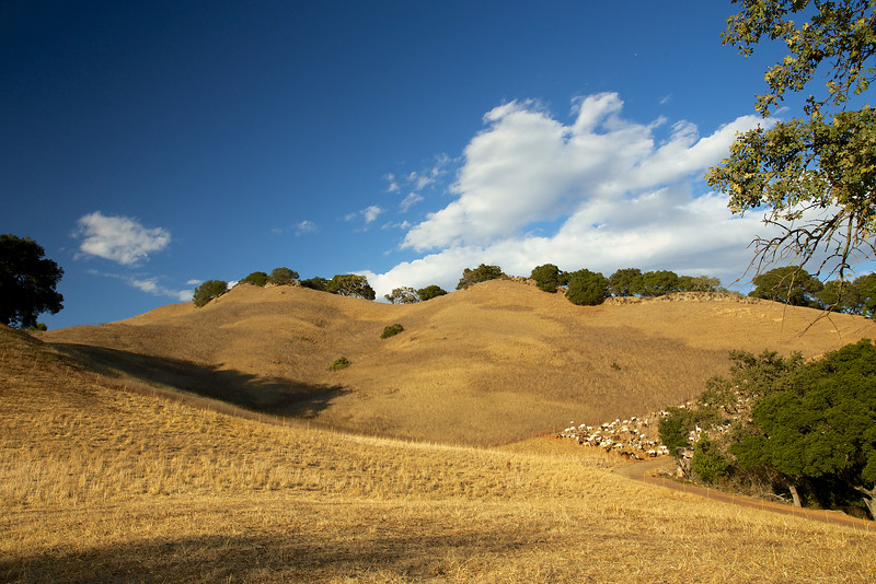
The sun was setting, and the light started to become more intense and direct. Up on the hills were little clusters of boulders, nestled under some dusty oaks. The grasses were a dry brown, and little tufts of thistle sprung up like periscopes along the hillside.

A late afternoon fall hillside
As I walked along this fire road trail I was heading west, in the direction of the setting sun. Occasionally, I turned around to capture the hills and clouds behind me.
The goats eating a wedge of the hillside
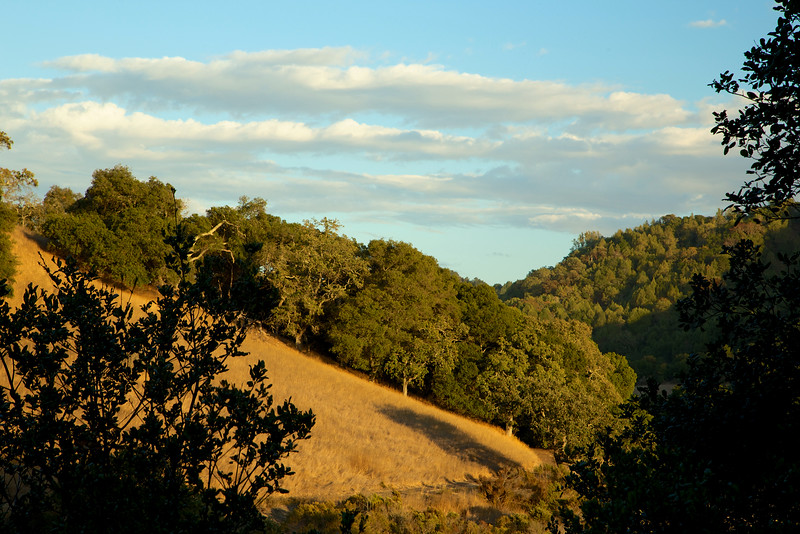
On the right side of the trail, facing north, the ridges were dotted with oaks, which were lit up by the direct light of the setting sun.
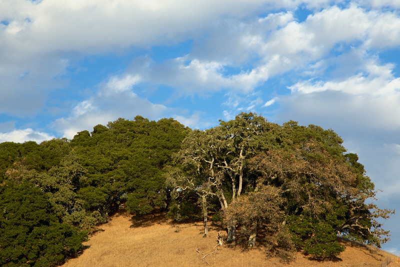
Along the trail, the clouds beautifully and mysteriously seemed to mirror the slope of the trees and hills.

Oaks and the floating clouds
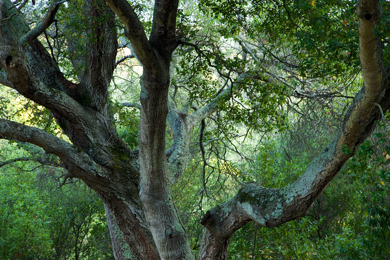
Just off the trail, clusters of oaks covered in moss and lichen seemed ghostly as the light danced across their leaves.

I reached a graceful setting of oaks stretching and bending to capture the last atom of sunlight for the day. The elegance and beauty of this little scene was the gift of this hike. Value and treasure the light in your life, and reach out and take it in as long as it lasts.
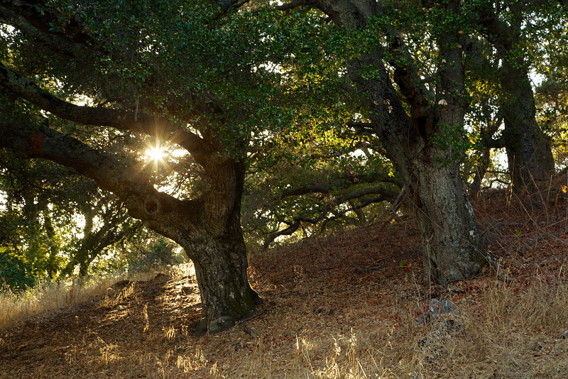
A beautiful oak reaches for one last embrace from the sun
Just past this grove, I reached a point where the sun lit up the whole hillside. The bright, direct light brought out the glow in the leaves.
A golden gaze bathes the hillside
I was in the golden hour, when the last touch of evening sunlight comes in warm and mellow. I realized how far I had hiked, and that I still had to return before I lost all light. I just didn't want to turn around, it was too spectacular.

The low sun lights up the trunks of these oaks, sentries to this part of the trail
The Oursan Trail is a part of a big loop around the reservoir. If I had started earlier, I might have been able to circle the whole reservoir. It's about 12 miles total, but I started later to focus on the afternoon sun. I turned around at about 3 miles in, just as the lines and shadows in the darkness became more mysterious and haunting.
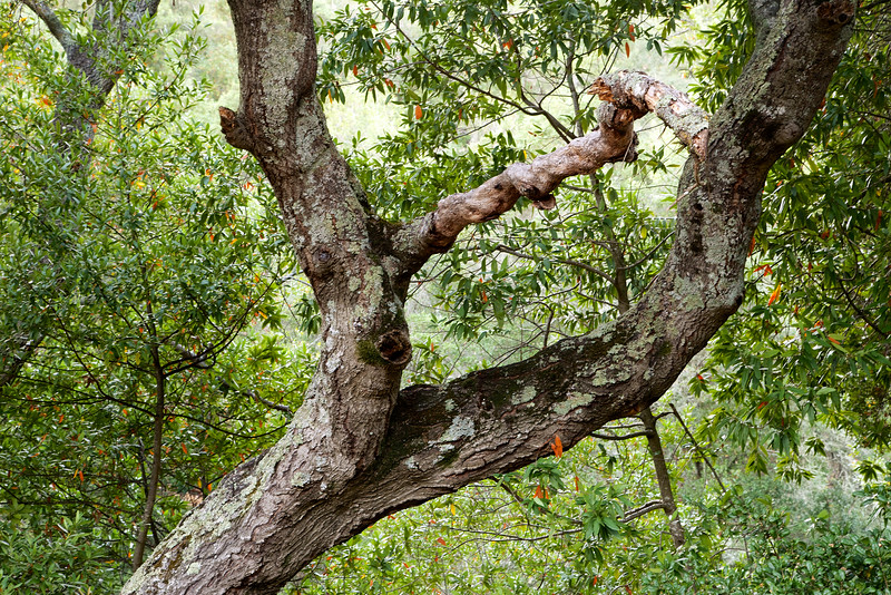
The hill octopus
The clouds, oaks and hillside made a layer cake for me, and it was a sweet scene. The sun was already slipping below the horizon, but was sending a last burst of light and energy.
Layer cake
In the retreating reservoir, white pelicans slumbered lazily in the cool breeze as evening shadows took over.

White Pelicans
On my way back, the light slipped away quickly. I captured a few more pictures with long exposures, but by now the trees were fading in to the darkness.
Rounding a corner, I turned to see what I had come for...the sunset over the reservoir. The distant hills made a little heart shaped dip, and the light on the water sparkled with a golden glaze.
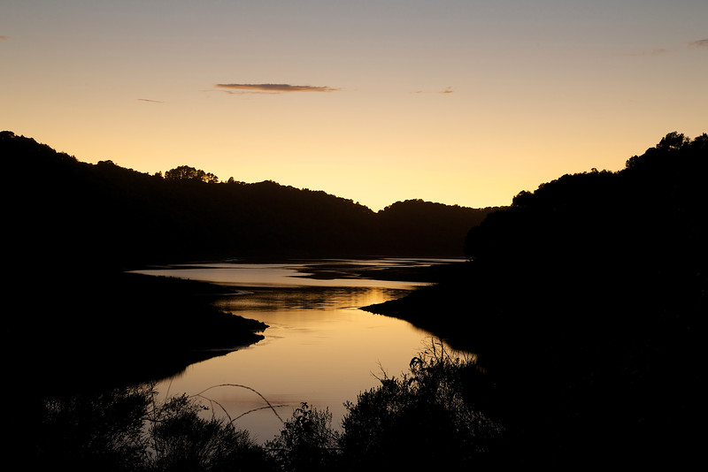
Sunset over Briones
On the way back, approaching the goats, I heard a chorus of coyotes across the hillside. Then, the owls accompanied me through the rest of the hike, who who'ing each other as I walked by quickly in the darkness. I passed the still eating goats and made it back to the trailhead about 20 minutes after sunset.
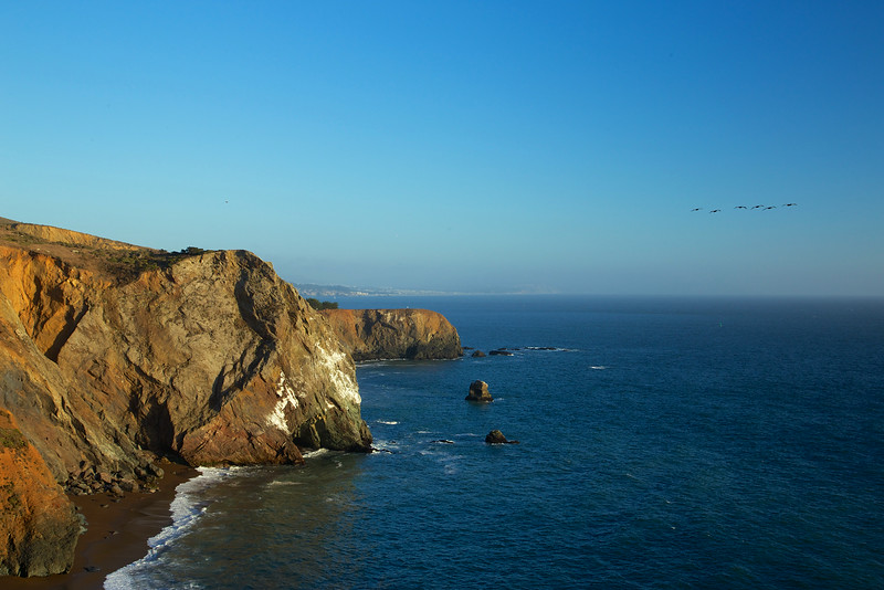
Tennessee Beach on a Sunny Afternoon
I hadn't even gotten to the parking lot when I saw a coyote cross the street on Tennessee Road. In the pre dawn hours, the heavy fog had created a shroud, and the coyote disappeared in to the mist the way he had appeared, like a ghost.
In the parking lot, a Mama quail led her bevy of offspring to seek hidden nuggets in the thick brush. I got my gear and loaded up, eager to take a hike on this popular and scenic trail.
The most common and easiest route is the simple out and back to Tennessee beach. At a flat 1.7 miles to the beach, this is a simple and pleasant stroll for most people. However, to see what Northern California coastal beauty looks like, you'll need to climb a hill.
From the parking lot, follow the signs to Tennessee Beach. Starting out on the paved trail, the first trail on the right is the Haypress Camp Trail. The second trail on the right is this path, the Fox Trail. Rabbits sprinted across the trail as I approached, wary of the foxes, coyotes and raptors in the shadows.
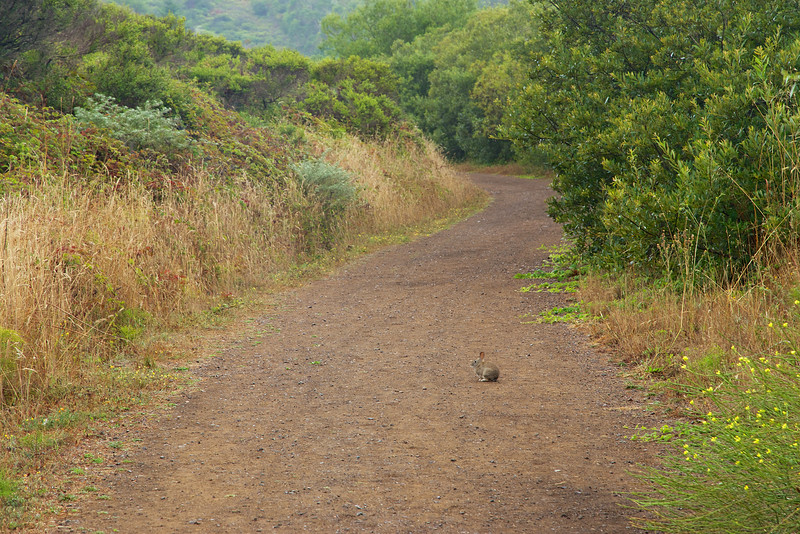
A rabbit on Fox Trail
Fox Trail is a climb, and on this hike, is most of the elevation gain in the loop. The early morning, fog was very heavy as I climbed. Often, quail would scurry across the wide, fire road trail. I heard their clicks as they hid in the bushes along the trail.
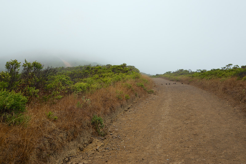
Mama Quail leading her brood in to the bushes
The fog contained a lot of healing moisture. The plants opened up, and drank heavily, becoming more vibrant and green. It was like a very light rain was coming down, and I had to wrap my camera in a plastic bag.
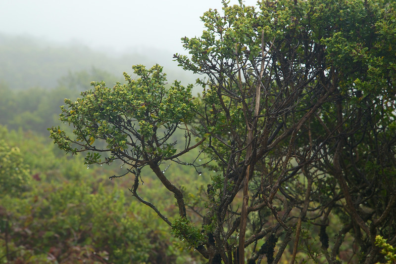
The mist gets thick and heavy, and the plants soak up the much needed moisture.
Secret gardens sprung up in the mist. As I approached the cliffs, I could hear the crashing waves, but not see anything beyond about 30 feet. I knew there were beautiful views of the coast, but they were hidden. Instead, this foggy mist revealed a landscape that hides in the sun and wind of the afternoon.
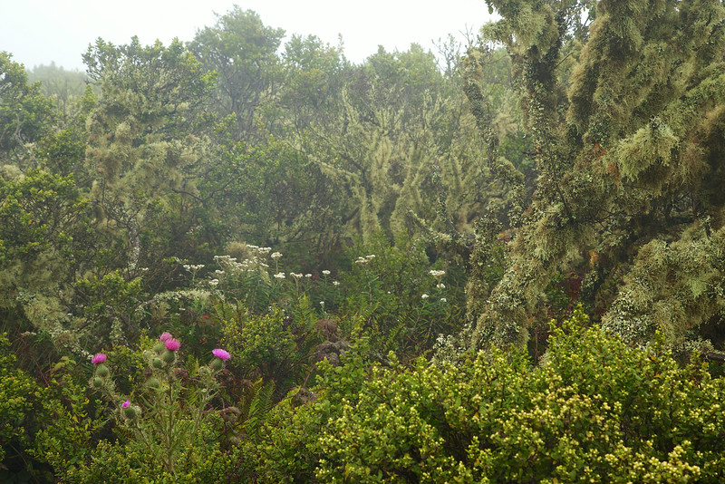
A coastal garden drinks up the fog
Since the fog hid the views of the coast, I took a left on Coastal Fire Road and started my descent. On the right is a rocky valley, and on the left on the climb down a the steep hillside.
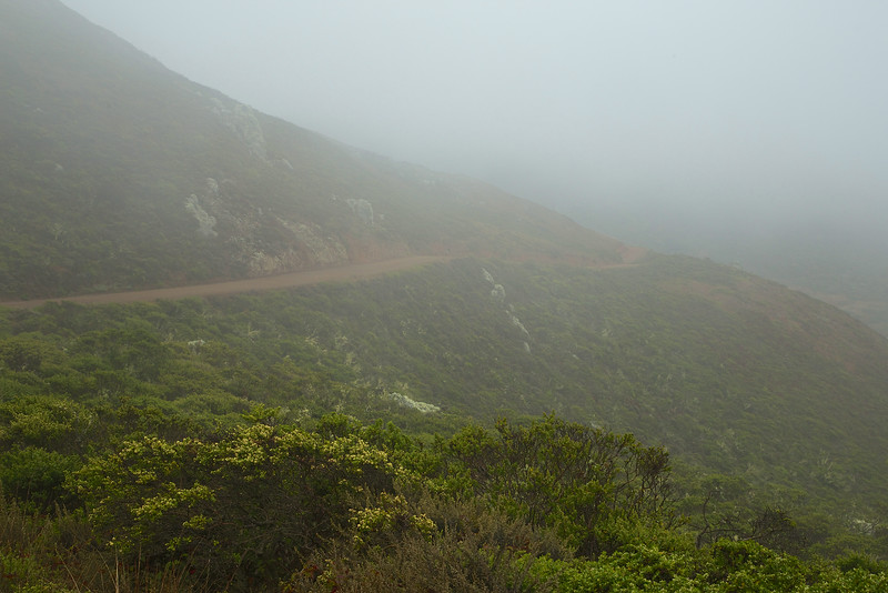
Coastal Trail disappears in to the fog
On the big boulders above and on my left, the lichen were flush with motion and vibrancy.
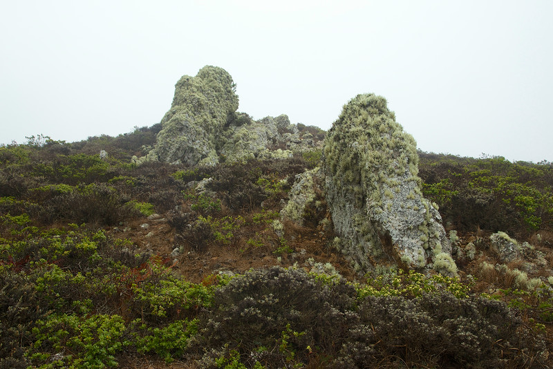
The lichen was soaking up the mist
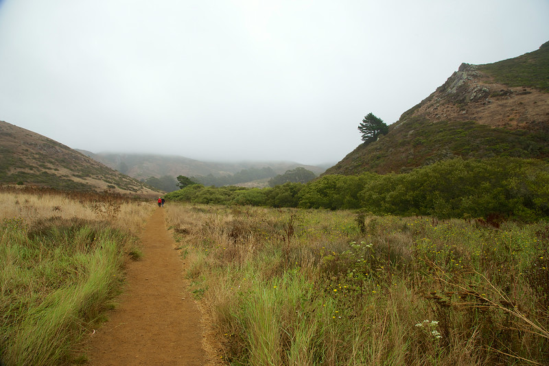
On the right as I descended, the valley comes in to view.

A teasing glimpse of the valley leading to Tennessee Beach
The beach and valley appear on the descent, and I took a right on to Tennessee Valley Trail and headed to the beach.

Tennessee Beach Trail. The building is a bathroom near the beach.
Just before I reached the beach, I passed a little lagoon with a lone duck.

The Lagoon next to the beach
Early in the morning the beach was mostly empty. The waves were slow and gentle, but seemed louder echoing off the giants at each end of the short beach.
If you visit at low tide, you might be able to view the wreckage of the S.S. Tennessee. In 1853, the steamship was targeting the golden gate in to San Francisco, but turned in to Tennessee cove. In the thick fog, the ship was damaged and beached on the cove. The captain managed to save all life, mail and the 14 crates of gold on board.
The Maritime Heritage Project has historical information on the sinking of the ship.
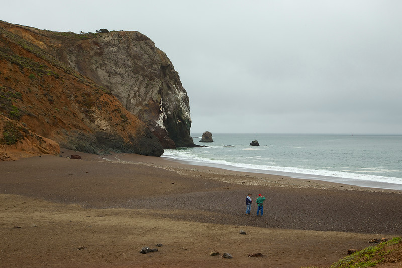
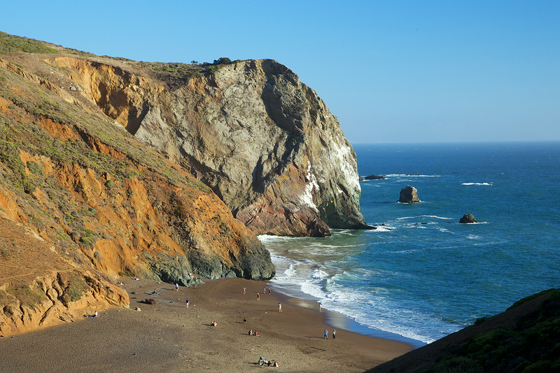
Tennessee Beach on an overcast morning
Standing on the beach and looking to your right, you'll see what to me looks like a sleeping baby elephant resting his head in the water. There used to be an arch across the neck. The arch collapsed last year, and a student was there to capture the event live.
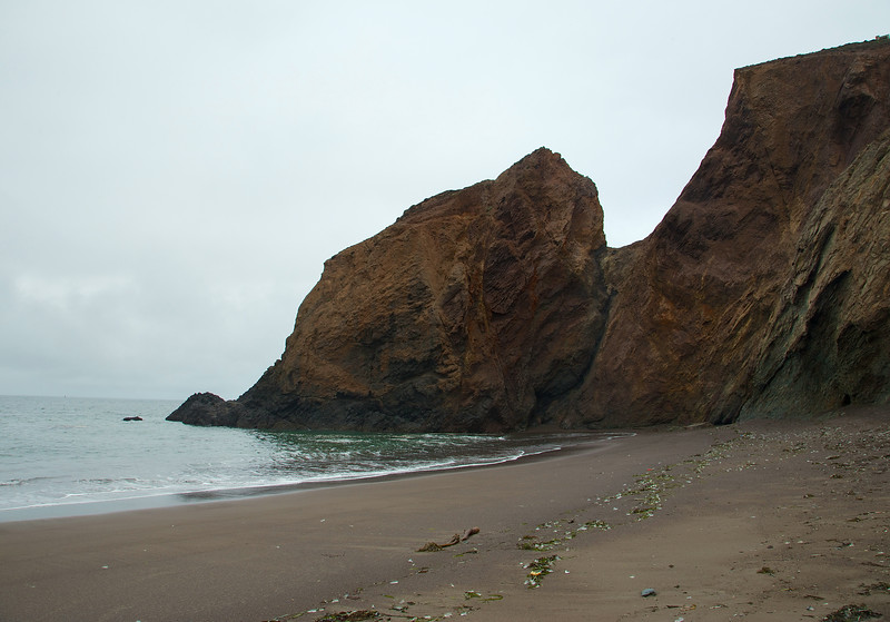
Baby elephant head?
Leaving the beach and the baby elephant, I made my way back to the parking area. The Tennessee Valley trail splits in to upper an lower trails, which merge again after a short distance. The lower trail is a single track trail with access to a few other trails along the way.
Lower Tennessee Valley Trail
Along the Tennessee Valley Trail, you'll see some interesting geological layers in the rock. There is a horse stable along the way, and you'll be able to see, hear and smell it. Parts of the trail are open to horses, so keep your eyes open for gifts along the way.

The exposed wall on the Tennessee Valley Trail
The fog and mist were a beautiful experience, but of course I wanted to see the star of the show, the great California coast.
A few days later I returned in the afternoon, with the expectation that I would retrace my route and see what I couldn't see the first time. Hiking up Fox Trail, I could now see the hills, sky and sea, along with circling raptors.
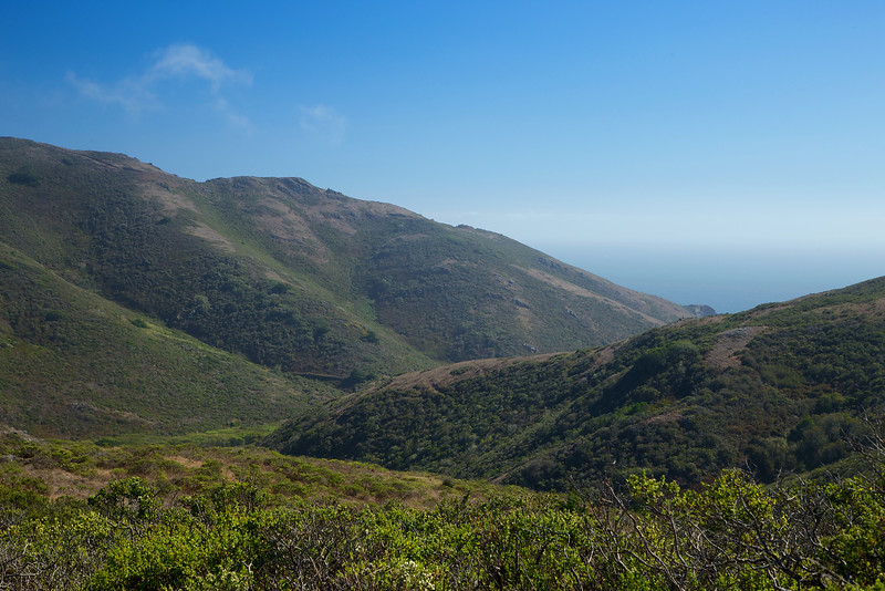
The views open up on a sunny afternoon
This area used to be a ranch, and there are still signs of fencing and barbed wire laying about.

Old fence posts along the Fox Trail, left over from an old ranch
The rolling hills, with a distant view of San Francisco, were once tempting targets for development. In fact, in 1965, developers got approval to build 50 apartment towers, along with hundreds of homes and a mall at the highest point in the hills! Click here to see what might have been...
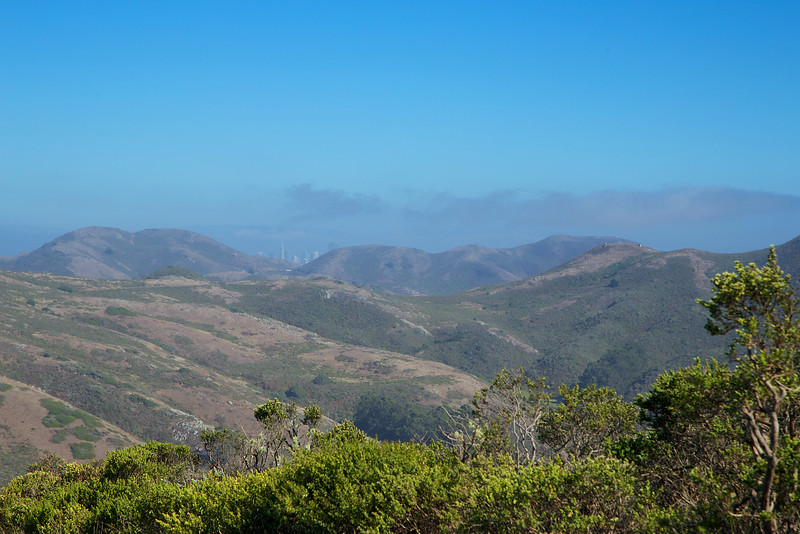
The San Francisco skyline peaks out over the distant hills
Fortunately, a group of dedicated and hard working people saved it for all of us, and eventually the land became part of the Golden Gate National Recreation Area.

A view of the coast
At the end of Fox Trail, Tennessee Valley can be seen off in the distance.
An off limit trail near the trail split
Going to the right will take you to Pirate's Cove. This is the northern view at the split.
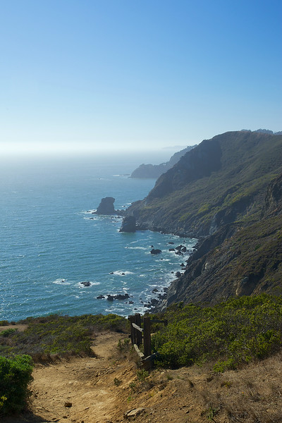
The trail leading to Pirates Cove
I walked a bit down the trail to Pirate's cove. Big, lichen covered boulders guard the trail along the way.
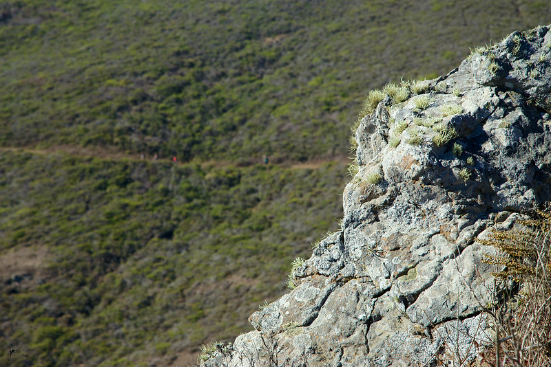
Hikers in the distance
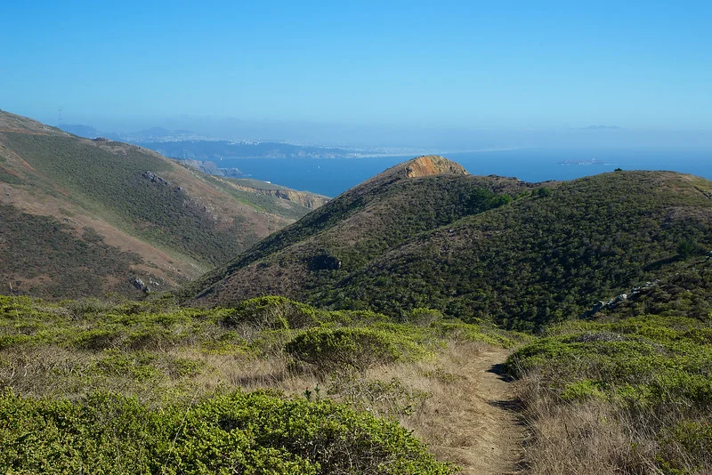
I turned around and headed back to my original route. Looking south, the hills roll a little more gently in to the sea.
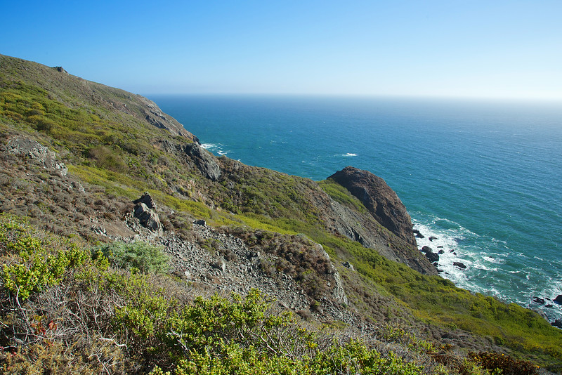
Wild fennel, sagebrush, coastal grasses and other bushes cover the hillside
It was getting later in the afternoon, so I headed to Tennessee Beach. The light and sky were much different from the foggy morning.

Tennessee Valley Trail
I made it to the beach as the sun retreated. Afternoon bathers were starting to head back as the wind and chill picked up.
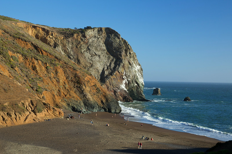
Tennessee Beach
Up behind the beach are stairs that lead up to an old bunker. Some bunkers in the Marin headlands have been here since the late 1800s, and were built to guard and protect San Francisco Bay.
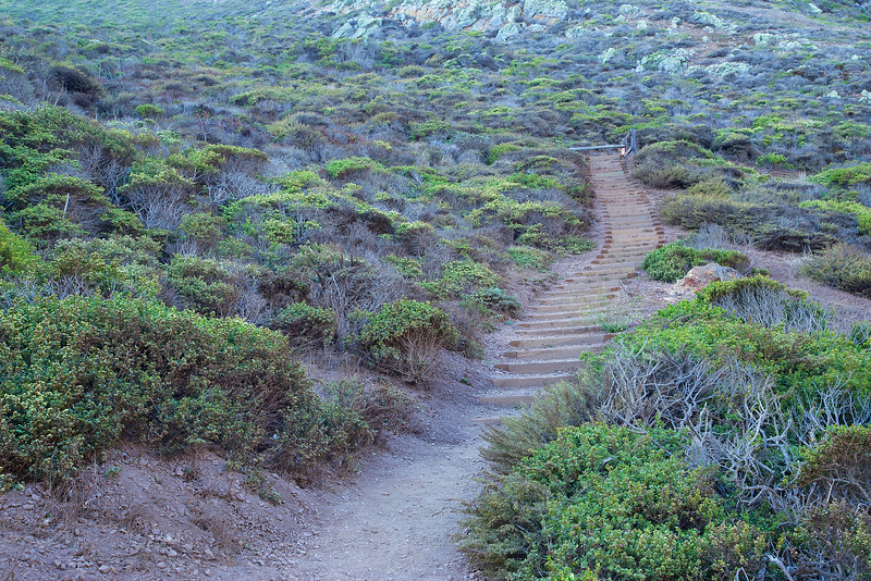
The steps up to the bunker
Up at the top of the stairs there was a little room built in to the hillside. The tiny interior was covered in grafitti. At one time, it probably was the living quarters of the bunker lookout.

Inside the sleeping room
At the top of the hill is the bunker. To reach the inside of the bunker, I had to climb down and walk along a very narrow ledge to get to the opening. This is a very dangerous area, with strong winds, narrow walkways and no protective fencing. The edge is a steep drop to the harsh rocks below. I would strongly urge you to avoid climbing in to this area. Instead, look at the pictures I took of the bunker in this gallery.
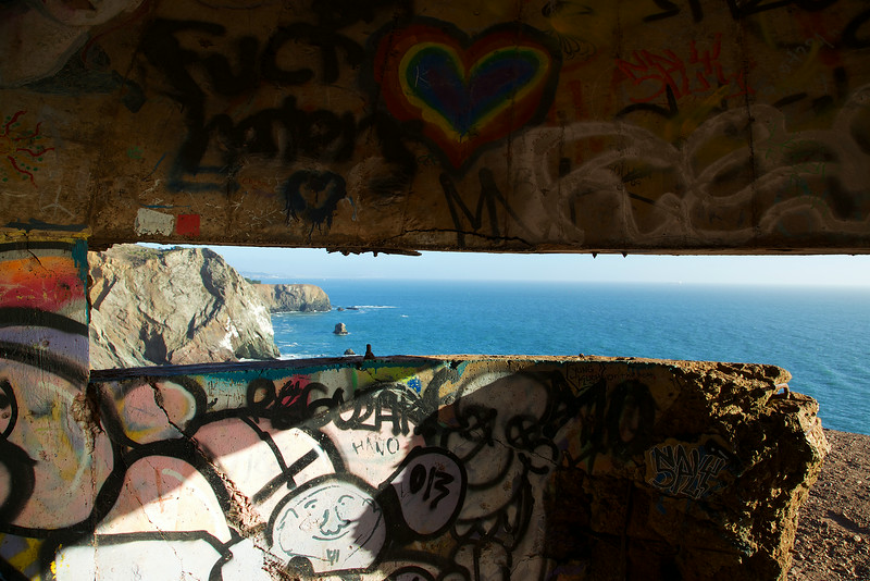
Inside the lookout bunker, looking to the cliffs
Leaving the bunker, I climbed back up and focused on the beach below. I was waiting for the last golden light of the sunset.

Kids playing on Tennessee Beach
As I waited, I watched the waves, the pelicans and distant container ships. Most people had left the beach by now, just moments before the last golden light.
Pelicans taking a trip up the coast
And then, as the sun disappeared and sent one last burst of light, a lone figure walked along the beach.
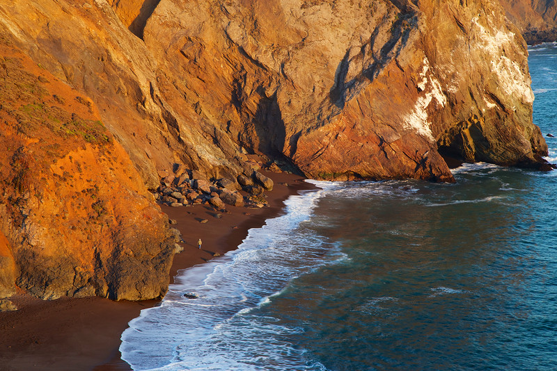
The golden light of sunset brightens the beach for a lone walker
I took a few moments of video to share the experiences of a foggy, and then sunny Tennessee beach:
Be safe, bring water and enjoy your trip!
Start at the Tennessee Valley Trailhead
Take a Right on to the Fox Trail
Take a Left on to Coastal Fire Road
Take a Left on to Coastal Trail
Take a Right on to Tennessee Valley Trail
Enjoy the Beach!
Walk back on Tennessee Valley Trail, and take the lower Tennessee Valley Trail
Trails merge, and you'll soon be back to the parking area
NOTICE: This parking area gets crowded on weekends, and you may need to park in one of the limited spaces along the approaching road. To truly enjoy your experience, get there early and avoid the crowds.
Click here for the Trip Planner
To Tennessee Valley from San Francisco
To Tennessee Valley from the East Bay
To Tennessee Valley from the North
One of the best redwood hikes in the world is less than a one day drive from the bay area...

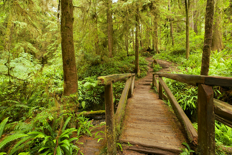
Bridge on the Boy Scout Tree Trail
Driving up from the Bay Area on US 101 N you'll travel through numerous redwood filled state parks. All are worth a visit, but for a spectacular experience through a cathedral of towering and ancient giants, keep driving all the way up to Crescent City and Jedediah Smith State Park.
Here, you'll hike the Boy Scout Tree Trail to visit the giant Boy Scout Tree, honoring the boys who blazed the trail to this tree:

Directions to trailhead: From Highway 101, at the south end of Crescent City, turn east on Elk Valley Road. After 1.5 miles, fork right on Howland Hill Road and continue east about four more miles to the signed trailhead located on the north side of the road
Start the hike at dawn. There will be few if any other hikers at that time, and you'll be alone in a forest full of trees, hundreds and some even thousands of years old. There are birds, but their chirps and whistles are quiet, except for the occasional squawking crow. And out on this trail, the silence is dotted with the pure sounds of nature, not cars, planes or industrial effluence. The old giants around you creak and moan, the sword ferns rustle, and the air is filled with the sweet mossy scent of old earth.
The trailhead is located off the unpaved single lane Howland Hill road. Just driving slowly on this road, early in the morning, gives you a feeling of the experience yet to come. Normally, the trailhead has an official marker, but on my visit there was just a sheet of paper stapled to a post. Let's hope they get the real marker back soon. There are about 6 or 8 spots for parking along the narrow road, another reason to get there early.
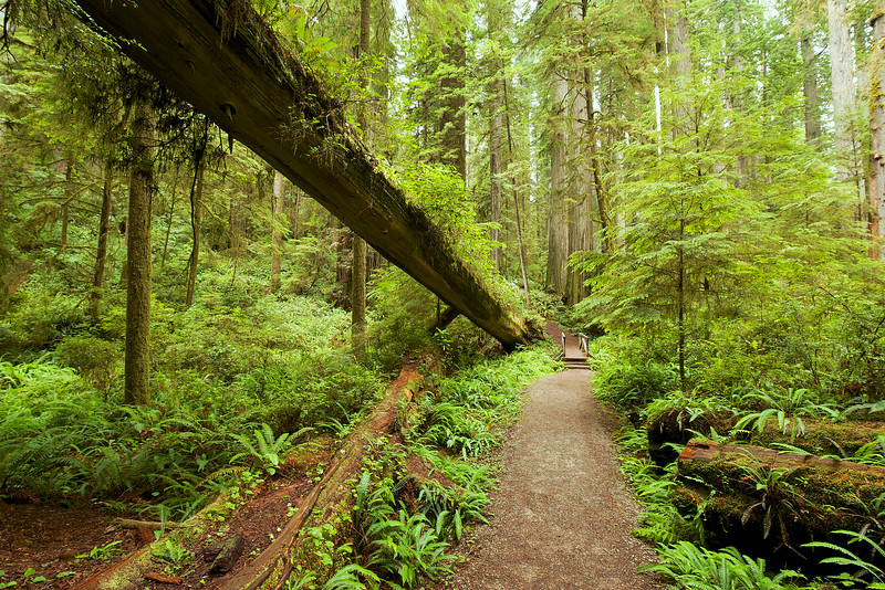
A bridge early in the trail. These fallen redwoods often take many years to break down.
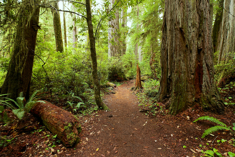
Hiking the first part of the trail, breathing in the forest air, feeling the soft and cushiony ground under your feet, all thoughts of the world you left behind will disappear. Here are trees that first poked through the soil before Columbus visited the continent, before the dark ages, before even the birth of Christianity. One undisclosed tree in the park has been determined by scientists to be over 2520 years old!
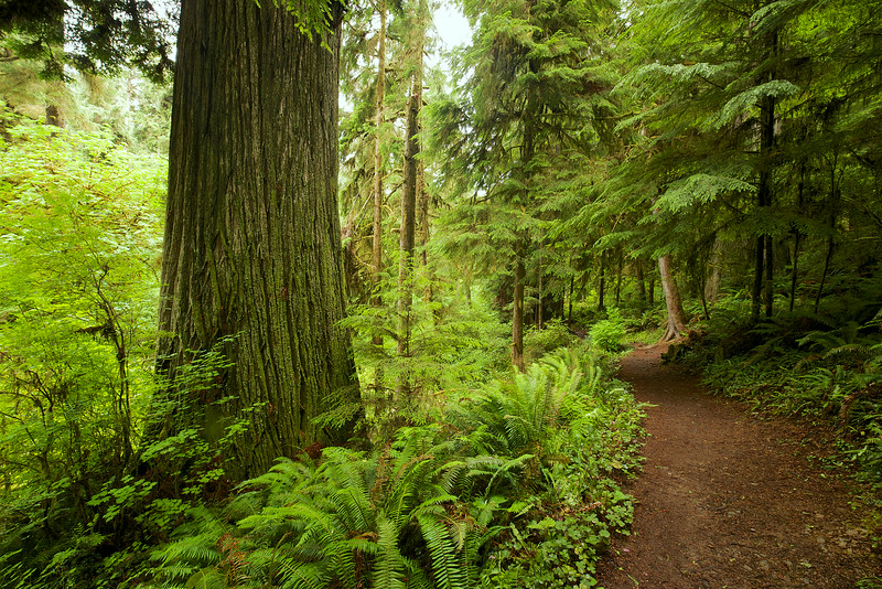
As you walk, you can see the story in their bark. The lines, the cracks, the mossy glow and the twisted, knotted burls reveal their character and resilience.

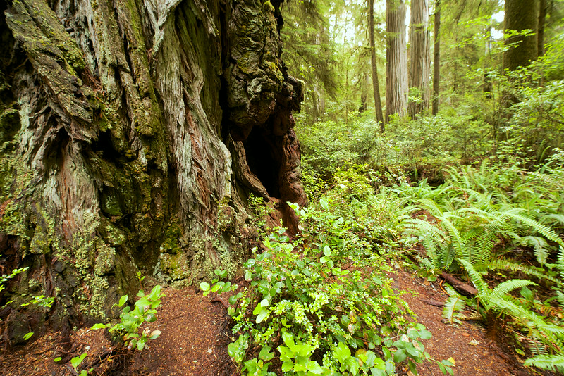
Next to a giant
The trail winds gently through the forest, with occasional ups and downs. This is not an endurance hike though, this is purely and simply a spiritual hike. You will be humbled, awed and filled with excitement. Every step brings a new vision, fresh light and a new perspective.

The giant redwoods stand firm at the base, and their crowns disappear hundreds of feet above you, where they wait for rolling banks of fog to catch. Redwoods thrive in the foggy conditions near the coast. The moisture generated from the fog supplies up to 40% of the tree's water needs.
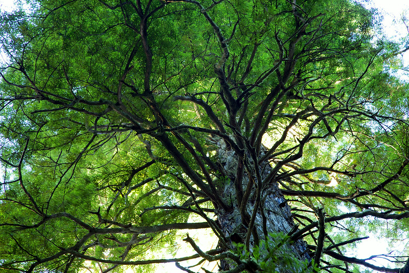
Looking up will give you a chance to see the branch structure in the crowns of the trees.
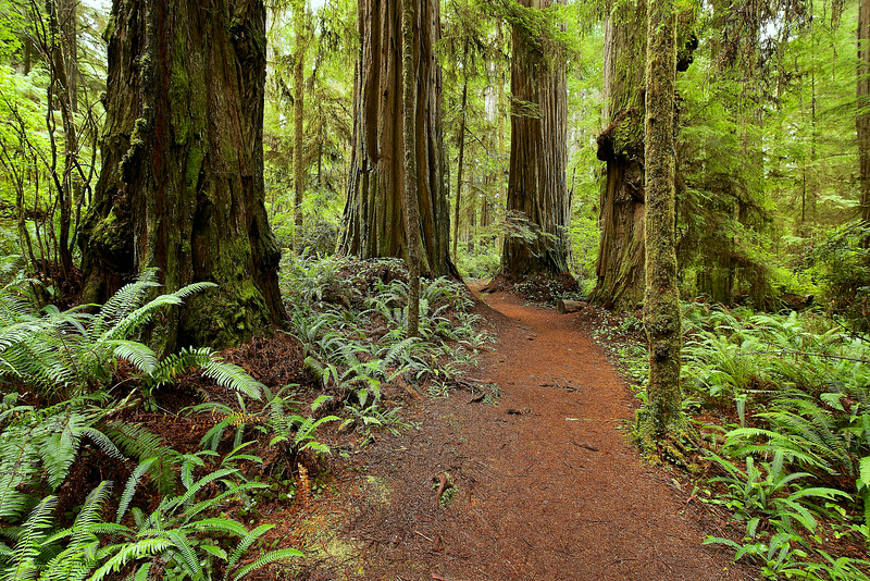
This is an old growth forest, untouched by loggers or other types of devastation. The forest has had an opportunity to develop multiple layers of canopy and a thick, cushiony floor. However, these forests are tempting targets for logging:
From the pages of the Crescent City American, July 1928.
The big tree which is known as the Boy Scout Tree after the Boy Scouts blazed a trail to it, about one mile from the Robert Howland home, has been figured up and if the tree was felled and cut into lumber, it would saw out over 165,000 board feet of lumber.
The mammoth redwood is 27 feet in diameter and over 400 feet tall. The tree is on the property of the Del Norte Timber Company.
Now, the park is protected open space. However, these beautiful trees face a new threats by poachers, environmental issues and drought. Learn more about how you can help protect the redwoods here.

This is a direct, out and back hike, with two destinations. At about 3 miles, the trail splits. To the right, up a short but steep hill, is the Boy Scout Tree. Returning back to the split and taking the other trail will lead you to Fern Falls, which is a gentle trickle in the summer. The distance from the tree to the falls is less than a quarter mile. The round trip, including the falls, is just over 6 miles.
Here are a few of my favorite scenes on my way to the Boy Scout Tree and Fern Falls:
One of the bridges over a light flowing stream. The trail disappears off in the distance.
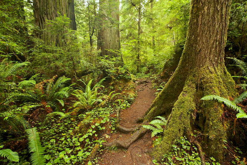
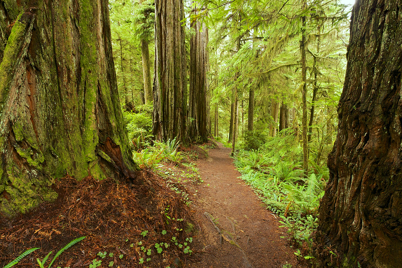
Sword ferns reach out to tickle your ankles, and roots jut out dramatically from the soil, so watch your step.
The trail pulls you in...
At the split, take the trail to the right, climb the short hill, and here he is, the big daddy, the Boy Scout Tree:
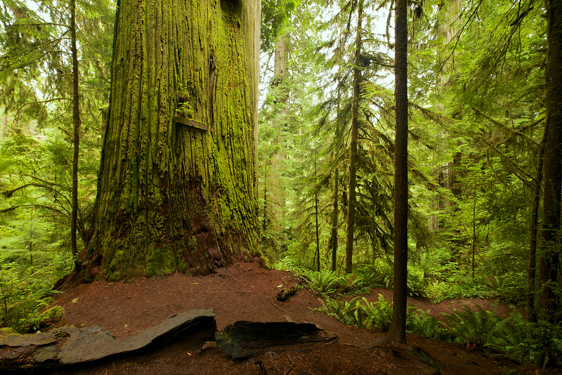
The sign on the tree says "Boy Scout Tree"
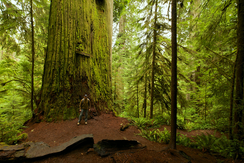
Here I am to give you some perspective...
After I took some time to meditate in the shadow of the giant, I went back down to the split and continued on the trail to Fern Falls. On the way I passed a mossy and mysterious section of the forest. Twisted maple branches were draped with a damp moss that moved gently with the breeze. Little chickadees chirped and flittered around me.


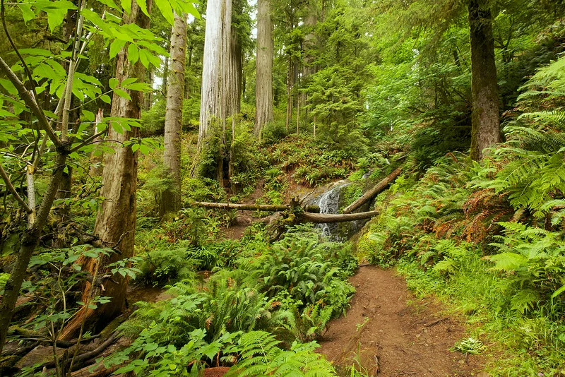
Approaching Fern Falls
Past a few more sections of the majestic giants, the forest opens up to reveal the falls:
Fern Falls, mid summer flow
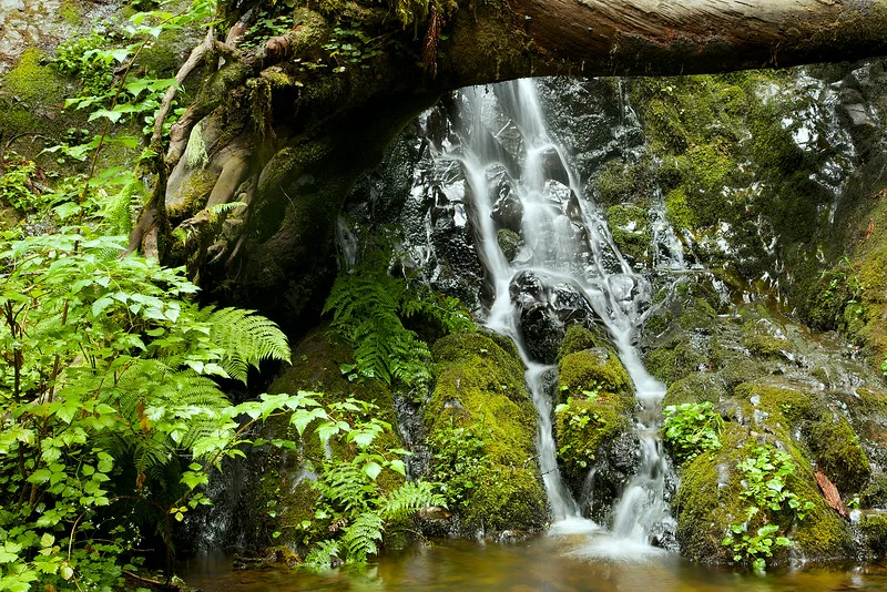
Close up of the falls.
The falls is a good place to sit and enjoy the internal calm and relaxation that this place generates. Streams and waterfalls release negative ions. When we breath these in, it is believed to stimulate the production of serotonin in our bodies. Serotonin is thought to improve mood and alleviate depressive states. If you don't already feel a sense of calm and well being in the forest, the falls will get you there.
On my return route, back to the trailhead, I switched lenses to be able to zoom in on certain features of the landscape.
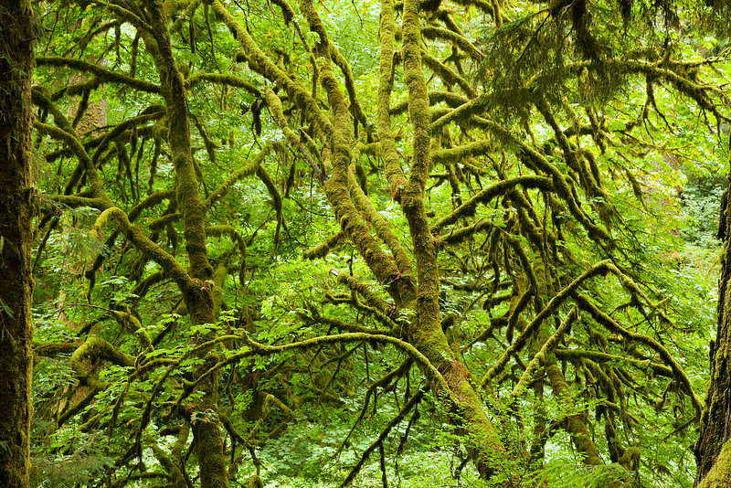
A tangle of mossy branches.
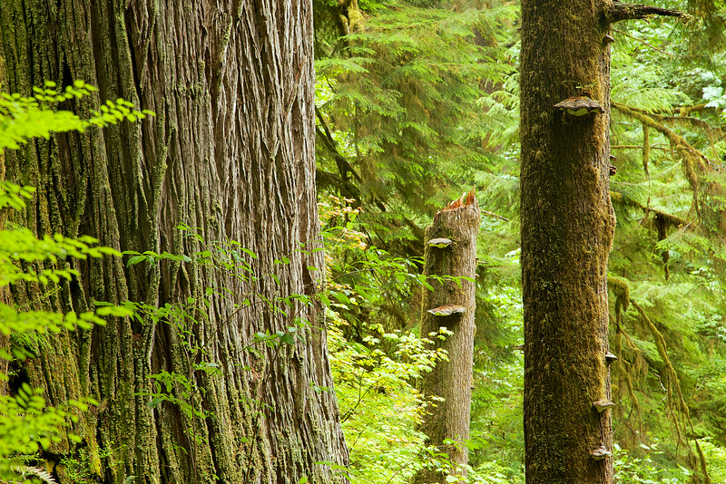
Mushrooms grow on decaying trees.

Lines, textures and patterns stand out
I found myself walking slower and slower. I didn't want to leave this place, and was honestly a little saddened when I started hearing the voices of other hikers approaching. This place feels like a beautiful gift. The vibrant and ancient life, the harmony, and the spiritual connection here generate a natural euphoria.
The fullness of your experience here is directly related to your respect of this forest. Enjoy and treat this park, and all of nature, as the gift it is.

Walking through the giants.